

- Usage in publication:
-
- Moorman Ranch member
- Modifications:
-
- Revised
- Dominant lithology:
-
- Limestone
- AAPG geologic province:
-
- Great Basin province
Summary:
Pg. 93 (chart 1), 106. (Road logs dated Sept. 8-10.) Moorman Ranch member of Pequop formation. Rank reduced to member status in Pequop formation. Referred to as Lower and Upper Moorman Ranch. In Moorman Ranch section, basal 1,750 feet of Pequop is referred to as Lower Moorman Ranch member. Lower member composed of grayish-orange to yellowish-tan micro- to fine-crystalline, thin- to medium-bedded limestone and thin interbeds of dark-yellowish-orange, fine-grained sandstone and silt; [early] Leonardian age fusulinids present throughout unit. Disconformably underlies Upper Moorman Ranch member. [See also Bissell, 1964 (AAPG Bull., v. 48, no. 4, p. 574, fig. 2) who shows on stratigraphic section of Elko and White Pine Cos., eastern NV, the Upper and Lower Moorman Ranch Members separated by the Summit Springs Member of Pequop]. Conformably overlies Riepetown sandstone (new). Upper member is 1,050 feet thick with lower 850 feet assigned to upper Leonardian, and remaining 200 feet lower Guadalupian. Underlies Loray formation.
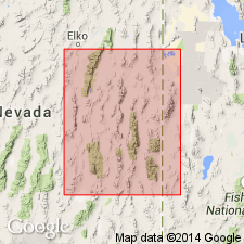
Moorman Ranch section is in T. 17 N., R. 59 E., White Pine Co., eastern NV.
[Lower Moorman Ranch member and Upper Moorman Ranch member not adopted by the USGS as formal members; nomenclature guidelines state the use of identical geographic names to several minor stratigraphic units in one vertical sequence is considered informal nomenclature (CSN, 1933; ACSN, 1961, 1970; NACSN, 1983, 2005, 2021).]
Source: US geologic names lexicon (USGS Bull. 1200, p. 2582, 3768).
For more information, please contact Nancy Stamm, Geologic Names Committee Secretary.
Asterisk (*) indicates published by U.S. Geological Survey authors.
"No current usage" (†) implies that a name has been abandoned or has fallen into disuse. Former usage and, if known, replacement name given in parentheses ( ).
Slash (/) indicates name conflicts with nomenclatural guidelines (CSN, 1933; ACSN, 1961, 1970; NACSN, 1983, 2005, 2021). May be explained within brackets ([ ]).