- Usage in publication:
-
- Moore Hollow Group
- Modifications:
-
- Named
- Dominant lithology:
-
- Sandstone
- Limestone
- AAPG geologic province:
-
- Llano uplift
- Strawn basin
- Kerr basin
- Bend arch
- Permian basin
Summary:
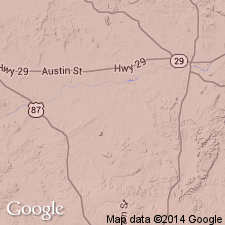
Named for Moore Hollow in southeastern part of Riley Mountains, Llano Co, TX. Type locality in East Canyon, just south of Moore Hollow, Llano Co, TX. Composed of (ascending): Riley Formation, consisting of Hickory Sandstone, Cap Mountain limestone, and Lion Mountain Sandstone Members; and Wilberns Formation, consisting of Wedge Sandstone, Morgan Creek limestone, Paint Peak, and San Saba Members, the latter composed of dolomite and calcite facies and some sandstone. Gradational boundary with overlying Ellenburger Group. Overlies Precambrian rocks. Exposed at surface only in Llano uplift, central TX. In subsurface, extends from margin of Ouachita tectonic province to where it terminates against Precambrian rocks in Permian basin. Has not been traced to Marathon area, TX or to Arbuckle area of OK. Thickness in outcrop area has a maximum of 1,460 ft and thickens to south in subsurface. To northwest, erosion has truncated the upper beds. Limestones are granular, fossiliferous, and colored gray, greenish gray, olive, and gray brown. Aphanitic stromatolites common in top Morgan Creek Limestone Member and upward. To east, grades into coarse-grained dolomite. Dolomite scarce in northwestern area. Glauconite is common and distinguishes it from Ellenburger group. Geologic map. Correlation chart. Isopach map. Age is Middle Cambrian to Early Ordovician.
Source: GNU records (USGS DDS-6; Denver GNULEX).
For more information, please contact Nancy Stamm, Geologic Names Committee Secretary.
Asterisk (*) indicates published by U.S. Geological Survey authors.
"No current usage" (†) implies that a name has been abandoned or has fallen into disuse. Former usage and, if known, replacement name given in parentheses ( ).
Slash (/) indicates name conflicts with nomenclatural guidelines (CSN, 1933; ACSN, 1961, 1970; NACSN, 1983, 2005, 2021). May be explained within brackets ([ ]).

