The National Geologic Map Database is migrating to a new infrastructure. We apologize for any service disruptions during this process.
|
|---|


- Usage in publication:
-
- Moody Brook formation
- Modifications:
-
- Named
- Dominant lithology:
-
- Schist
- Gneiss
- AAPG geologic province:
-
- New England province
Summary:
Pg. 11 (table 1), 22-24, pls. 1. 2. Moody Brook formation [author does not capitalize rank terms; however, units are considered formal]. Consists mainly of migmatic gneiss with dark fraction made up of dense quartz-feldspar-biotite schist and quartz-feldspar-two-mica-sillimanite schist. Thickness is about 600 feet. Overlies the Berry Ledge formation (new). To the north, the Moody Brook is in fault contact with some units of northern sequence and with the Songo granodiorite. May correlate with the upper part of the Waterville formation (as defined by Osberg, in prep.) in Waterville area. Age is Silurian.
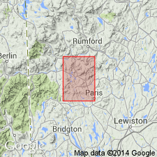
Type locality: along upper part of Moody Brook, Bryant Pond quadrangle, Oxford Co., southwestern ME. Also well exposed on hills immediately north of West Paris and hill just east of Stearns Hill.
Source: US geologic names lexicon (USGS Bull. 1350, p. 500-501).
- Usage in publication:
-
- Moody Brook Member
- Modifications:
-
- Revised
- AAPG geologic province:
-
- New England province
Summary:
Sangerville Formation, in the Buckfield area, is divided into (ascending): Moody Brook, Berry Ledge, Noyes Mountain, Patch Mountain, and Turner Members. Buckfield Group not used Moody Brook overlies Anasagunticook Member of Waterville Formation. [Intent to revise the above units is not stated, but subdivision of the Sangerville and its lower contact are clearly shown in a stratigraphic column.] Order of younging within the sequence differs from reports of previous workers. Graded sequences suggest an inverted lithologic package. Rocks in area subjected to three deformational events.
Source: GNU records (USGS DDS-6; Reston GNULEX).
For more information, please contact Nancy Stamm, Geologic Names Committee Secretary.
Asterisk (*) indicates published by U.S. Geological Survey authors.
"No current usage" (†) implies that a name has been abandoned or has fallen into disuse. Former usage and, if known, replacement name given in parentheses ( ).
Slash (/) indicates name conflicts with nomenclatural guidelines (CSN, 1933; ACSN, 1961, 1970; NACSN, 1983, 2005, 2021). May be explained within brackets ([ ]).