

- Usage in publication:
-
- Monumental Mills Formation
- Modifications:
-
- Named
- Dominant lithology:
-
- Sandstone
- Siltstone
- Mudstone
- AAPG geologic province:
-
- Piedmont-Blue Ridge province
Summary:
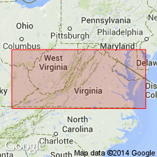
The Monumental Mills Formation of the Lynchburg Group in the Culpeper area, VA, is here named. It contains two informal members: 1) a lower sandstone member consisting of gray, fine- to medium-grained, well-sorted sandstone and siltstone which makes up the bulk of the formation, and 2) an upper siltstone member consisting of dark-gray to greenish, thinly laminated siltstone and mudstone. The outcrop belt of the Monumental Mills is 0-1,500 m wide and thins to the south. Contacts are not exposed, but it appears to gradationally overlie the Bunker Hill Formation; sharply underlies the Thorofare Mountain Formation. Age is Late Proterozoic, based on an age range of 730 to 570 Ma for the Lynchburg Group.
Source: GNU records (USGS DDS-6; Reston GNULEX).
- Usage in publication:
-
- Monumental Mills Formation*
- Modifications:
-
- Revised
- AAPG geologic province:
-
- Piedmont-Blue Ridge province
Kasselas, G.D., 1993, Stratigraphic framework, structural evolution and tectonic implications of the eastern Blue Ridge sequence in the central Appalachians near Warrenton, Virginia: Virginia Polytechnic Institute and State University, Department of Geological Sciences M.S. thesis, __ p.
Summary:
Monumental Mills Formation here mapped in Warrenton, VA, area as part of the Lynchburg Group or part of the Fauquier Group (rank raised) (north of Carter Run fault. Thickness ranges from 450 to 1850 m. Conformably overlies Bunker Hill Formation, which is basal formation of both groups; overlain by either Ball Mountain Formation in Lynchburg Group, or by lower member of Swains Mountain Formation (new) of Fauquier Group. Wehr's (1985) informal subdivisions are not recognized in this area. Divided into six facies: sandstone and siltstone; sandstone; siltstone and mudstone; mudstone; quartzofeldspathic wackes; and sandstone.
Source: GNU records (USGS DDS-6; Reston GNULEX).
- Usage in publication:
-
- Monumental Mills Formation*
- Modifications:
-
- Revised
- AAPG geologic province:
-
- Piedmont-Blue Ridge province
Summary:
Monumental Mills Formation assigned to Fauquier Group (rank raised). Report includes geologic maps, correlation chart, and isotopic data.
Source: GNU records (USGS DDS-6; Reston GNULEX).
For more information, please contact Nancy Stamm, Geologic Names Committee Secretary.
Asterisk (*) indicates published by U.S. Geological Survey authors.
"No current usage" (†) implies that a name has been abandoned or has fallen into disuse. Former usage and, if known, replacement name given in parentheses ( ).
Slash (/) indicates name conflicts with nomenclatural guidelines (CSN, 1933; ACSN, 1961, 1970; NACSN, 1983, 2005, 2021). May be explained within brackets ([ ]).