The National Geologic Map Database is migrating to a new infrastructure. We apologize for any service disruptions during this process.
|
|---|


- Usage in publication:
-
- Monument Creek group*
- Modifications:
-
- Original reference
- Dominant lithology:
-
- Sandstone
- Gravel
- AAPG geologic province:
-
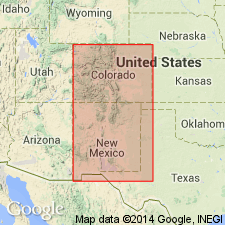
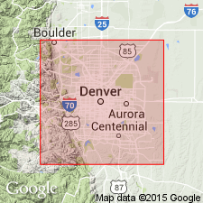
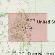
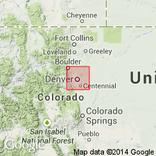
- Denver basin
Summary:
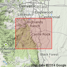
Pg. 39-40, 89. Monument Creek group. Variegated sands, sandstones, and arenaceous clays, nearly horizontal, resting on upturned edges of older rocks. They range from coarse puddingstones to very fine-grained sands or sandstones; very little lime in entire series; much ferruginous matter. Occurs 40 miles south of Denver, in region of South Platte Canyon to Colorado City, eastern central Colorado. Occupies space about 40 miles east to west and 60 miles north to south. Monument Creek [Castle Rock and Colorado Springs quadrangles] flows through this tertiary basin.
Source: US geologic names lexicon (USGS Bull. 896, p. 1413-1414).
- Usage in publication:
-
- Monument Creek group
- Modifications:
-
- Areal extent
- AAPG geologic province:
-
- Denver basin
Summary:
Pg. 32, 36-37. The peculiar group of fresh-water strata which in 1869 I called the Monument Creek group, extends to a point within about 20 miles of Denver, where the lignitic sediments return to their usual character. The group is 1,500 feet thick and consists of (descending): (1) variegated sandstones, brick red, white, and yellow, varying from fine-grained sandstone to puddingstone; (2) rather massive sandstone, varying from puddingstone to fine-grained sandstone, usually of light color, sometimes a yellow or iron rust. It may be synchronous with upper part of White River group [Oligocene].
Source: US geologic names lexicon (USGS Bull. 896, p. 1413-1414).
- Usage in publication:
-
- Monument Creek beds*
- Modifications:
-
- Areal extent
- AAPG geologic province:
-
- Denver basin
Summary:
Pg. 86-112. Monument Creek beds. Embraces true Monument Creek group of Hayden Survey. Extends only short distance into southeastern corner of Denver region, but occupies immense area beyond. Its manner of occurrence shows a break in continuity of its deposition sufficient in point of time for formation of a bed of rhyolitic tuff 40 feet thick. This bed of lava does not extend into Denver field but is well exposed in vicinity of Castle Rock. Though the group is perfectly divisible into 2 distinct formations it is for present better to retain name first given, more particularly to its lower member, as a designation for entire group, especially in view of very meagre information. Age undetermined. Thickness 1,500 feet. Unconformably overlies Denver beds. In places rests on Laramie, showing absence of Denver beds and underlying Willow Creek [Arapahoe] beds. Eruptive material is prominent in upper part and absent in lower part.
Source: US geologic names lexicon (USGS Bull. 896, p. 1413-1414).
- Usage in publication:
-
- Monument Creek formation
- Modifications:
-
- Revised
- AAPG geologic province:
-
- Denver basin
Summary:
(Chapter III, Section IV by G.H. Eldridge, p. 252-254.) Applied Monument Creek formation to Tertiary beds overlying Denver formation in Denver basin.
Source: US geologic names lexicon (USGS Bull. 896, p. 1413-1414).
- Usage in publication:
-
- Monument Creek formation
- Modifications:
-
- Revised
- AAPG geologic province:
-
- Denver basin
Summary:
Pg. 96-109. Monument Creek group of Hayden is here divided, in Castle Rock region, into Castle conglomerate above (90 feet thick, and resting unconformably on the lava) and Monument Creek formation restricted below. The name originally applied by Hayden is thus retained for the formation, which is best known, and the new and less cumbersome name Castle conglomerate is given to the less extensive and little-known formation. The Monument Creek formation restricted consists of conglomerates, breccias, sands, and clays which alternate, intermingle, and grade into each other in most lawless manner. It underlies the rhyolite and overlies Arapahoe formation. [Age is Oligocene and Eocene.]
Source: US geologic names lexicon (USGS Bull. 896, p. 1413-1414).
- Usage in publication:
-
- "Monument Creek group"
- Modifications:
-
- Abandoned
- AAPG geologic province:
-
- Denver basin
Summary:
†Monument Creek group abandoned. "Monument Creek group" of Hayden included Castle Rock conglomerate (Oligocene and 300 feet thick) and Dawson arkose (Eocene and 2,000+/- feet thick). The Dawson is = Denver and Arapahoe formations and some younger beds. These younger beds and the Castle Rock conglomerate were included in "Monument Creek formation" of Emmons, Cross, and Eldridge.
Source: US geologic names lexicon (USGS Bull. 896, p. 1413-1414).
For more information, please contact Nancy Stamm, Geologic Names Committee Secretary.
Asterisk (*) indicates published by U.S. Geological Survey authors.
"No current usage" (†) implies that a name has been abandoned or has fallen into disuse. Former usage and, if known, replacement name given in parentheses ( ).
Slash (/) indicates name conflicts with nomenclatural guidelines (CSN, 1933; ACSN, 1961, 1970; NACSN, 1983, 2005, 2021). May be explained within brackets ([ ]).