

- Usage in publication:
-
- Montgomery member
- Modifications:
-
- Original reference
- Dominant lithology:
-
- Clay
- Sand
- Gravel
- AAPG geologic province:
-
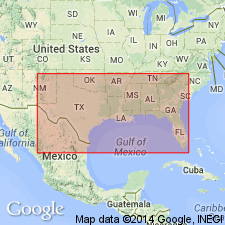
- Arkla basin
Summary:
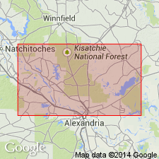
Pg. 78 (fig. 6), 160-163. Montgomery member. The series of Pleistocene deposits in Grant and La Salle Parishes is divided into four members, their names corresponding to the four distinct depositional terrace surfaces, Williana (oldest), Bentley, Montgomery, and Prairie. Montgomery member consists of clays and sands, the sandier materials predominating with depth; gravels common but are marginal deposits, reworked concentrations in form of large alluvial fans; highly oxidized plastic red-colored clays at surface grade downward at a depth of 2 feet into mottled red to yellow clays with thin lenses of silty sands; at depth of 20 feet, clays are generally replaced by a thin-bedded group of light-brown to yellow clays and sands which weather into "pinnacly clays"; slightly weathered clays are light brown to bluish gray and carry carbonized wood fragments and leaf impressions. Thickness uncertain; wells drilled on terrace surface encountered as much as 115 feet of clays and sands. Overlies Miocene Catahoula formation. Age is Pleistocene.
Named from exposures near Montgomery, Grant Parish, central LA. Well exposed at Waddel Bluff, in sec. 8, T. 7 N., R. 4 W.
Source: US geologic names lexicon (USGS Bull. 1200, p. 2571-2572).
- Usage in publication:
-
- Montgomery formation*
- Modifications:
-
- Revised
- AAPG geologic province:
-
- Gulf Coast basin
Summary:
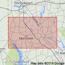
Pg. 180-182, pl. 1. Montgomery formation. Rank raised to formation. Described in Rapides and Avoyelles Parishes, southwestern Louisiana, where it underlies Prairie deposits and Recent alluvium. Age is Pleistocene.
Source: US geologic names lexicon (USGS Bull. 1200, p. 2571-2572).
- Usage in publication:
-
- Montgomery formation*
- Modifications:
-
- Areal extent
- AAPG geologic province:
-
- Arkla basin
Summary:
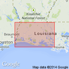
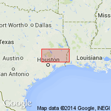
Pg. 143-144. Montgomery formation. Geographically extended into eastern Texas. Thickness in southwestern Louisiana ranges from 85 to 125 feet. Age is Pleistocene.
Source: US geologic names lexicon (USGS Bull. 1200, p. 2571-2572).
- Usage in publication:
-
- Montgomery formation*
- Modifications:
-
- Areal extent
- AAPG geologic province:
-
- Gulf Coast basin
Summary:
Pg. 71-74. Montgomery formation. In vicinity of Oakdale [Allen Parish, southwestern Louisiana], overlies Foley formation (new). Age is Pleistocene.
Source: US geologic names lexicon (USGS Bull. 1200, p. 2571-2572).
- Usage in publication:
-
- Montgomery Formation
- Modifications:
-
- Not used (revised 1992 edition)
- AAPG geologic province:
-
- Gulf Coast basin
Summary:
[Montgomery Formation not used (revised 1992 edition). = upper part of Lissie Formation. See entry under Lissie.]
1968 edition: Montgomery Formation. Clay, silt, sand, and very minor siliceous gravel of granule and small pebble size, locally calcareous, concretions of calcium carbonate, iron oxide, and iron-manganese oxides common in zone of weathering. Fluviatile. Surface fairly flat and featureless except for numerous rounded shallow depressions and pimple mounds. Thickness about 100 feet. Previously mapped as upper part of Lissie Formation. Overlies Bentley Formation [=lower part of Lissie Formation, revised 1992 edition]; underlies Beaumont Formation. Age is Pleistocene. Mapped mostly in southern and eastern parts of map sheet in an irregular, discontinuous, roughly southwest-northeast trending belt in northern Harris, southeast Montgomery, northern Liberty, Hardin, Jasper, and Newton Cos., TX.
Source: Modified from GNU records (USGS DDS-6; Denver GNULEX).

- Usage in publication:
-
- Montgomery Formation
- Modifications:
-
- Not used
Summary:
Is Pleistocene formation that is not used in this map sheet. The Lissie Formation (Pleistocene) is mapped in the eastern part of this map sheet and it is noted that the Montgomery and Bentley Formations (upper and lower units of the Lissie) are essentially indistinguishable and are thus not separately mapped. [See Lissie Formation.]
Source: GNU records (USGS DDS-6; Denver GNULEX).
- Usage in publication:
-
- Montgomery unit*
- Modifications:
-
- Revised
- AAPG geologic province:
-
- Gulf Coast basin
Summary:
Revises Montgomery to unranked informal unit because there are no diagnostic distinctions for delineating it from a recognizable underlying unit. Study area is Houston Ridge in Calcasieu Parish, southwest Louisiana, Gulf Coast basin. Underlies Montgomery and Perkins surfaces. Consists mostly of muddy sediments representing an alluvial depositional facies. Unit is at least 30 m thick. Age is Pleistocene (pre-Sangamonian). Report includes measured section (table 1).
Source: Modified from GNU records (USGS DDS-6; Denver GNULEX).
For more information, please contact Nancy Stamm, Geologic Names Committee Secretary.
Asterisk (*) indicates published by U.S. Geological Survey authors.
"No current usage" (†) implies that a name has been abandoned or has fallen into disuse. Former usage and, if known, replacement name given in parentheses ( ).
Slash (/) indicates name conflicts with nomenclatural guidelines (CSN, 1933; ACSN, 1961, 1970; NACSN, 1983, 2005, 2021). May be explained within brackets ([ ]).