

- Usage in publication:
-
- Monte Largo Metamorphics
- Modifications:
-
- First used
- Dominant lithology:
-
- Gneiss
- Schist
- Quartzite
- AAPG geologic province:
-
- Southern Rocky Mountain region
- Southwestern Basin-and-Range region
Summary:
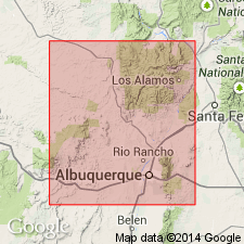
First published use of name applied to some quartz-feldspar gneisses, hornblende and biotite gneisses, muscovite, and hornblende schists, and quartz. Some small bodies of carbonatite. Intent to name and designation of a type not stated Probably named for Monte Largo, Bernalillo Co. Exposed 1) in a northeast-trending horst between Tijeras and Gutierrez faults, Bernalillo Co, NM in the Southwestern Basin-and-Range region, 2) in two separated areas on east side of Manzano Mountains in Bernalillo Co, and 3) across the Bernalillo-Sandoval (Southern Rocky Mountain region) Co line. Intruded by Sandia Granite (first used). Intruded locally by small bodies of carbonatite and quartz-tourmaline-calcite rock. Geologic map. Precambrian age.
Source: GNU records (USGS DDS-6; Denver GNULEX).
For more information, please contact Nancy Stamm, Geologic Names Committee Secretary.
Asterisk (*) indicates published by U.S. Geological Survey authors.
"No current usage" (†) implies that a name has been abandoned or has fallen into disuse. Former usage and, if known, replacement name given in parentheses ( ).
Slash (/) indicates name conflicts with nomenclatural guidelines (CSN, 1933; ACSN, 1961, 1970; NACSN, 1983, 2005, 2021). May be explained within brackets ([ ]).