

- Usage in publication:
-
- Montauk drift*
- Modifications:
-
- Named
- Dominant lithology:
-
- Till
- Gravel
- AAPG geologic province:
-
- Atlantic Coast basin
Summary:
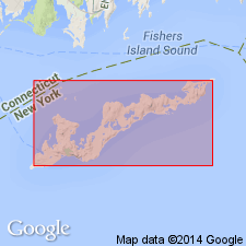
Montauk drift is name here applied to glacial deposits unconformably overlying Herod gravel on Fishers Island, NY.
Source: GNU records (USGS DDS-6; Reston GNULEX).
- Usage in publication:
-
- Montauk drift*
- Modifications:
-
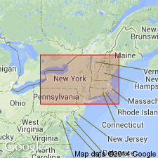
- Areal extent
- Overview
- AAPG geologic province:
-
- Atlantic Coast basin
- New England province
Summary:
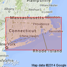
Montauk drift consists of hard, compact dark-gray, often partly cemented till. Thickness ranges from 75 to 150 ft thick. Occurs on Long Island, Fishers Island, and Cape Cod. Overlies Herod gravels and underlies granitic gravels which resemble Jameco and Herod formations. Probably of Illinoian age. (See also USGS Bulletin 285, p. 432-441).
Source: GNU records (USGS DDS-6; Reston GNULEX).
- Usage in publication:
-
- Montauk till member*
- Modifications:
-
- Revised
- AAPG geologic province:
-
- Atlantic Coast basin
Summary:
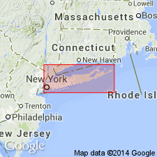
Manhasset gravels here referred to as Manhasset formation. Formation consists of glacial deposits, 150 to 250 ft thick, and is correlated with Illinoian stage of Mississippi Valley. Divided into ascending Herod gravel member, Montauk till member, and Hempstead gravel member. Contacts between members are unconformable. The Montauk consists of two beds of till separated by a gravel bed. Thickness ranges from 0 to 60 ft on Long Island. Time of deposition called Montauk substage.
Source: GNU records (USGS DDS-6; Reston GNULEX).
- Usage in publication:
-
- Montauk till member*
- Modifications:
-
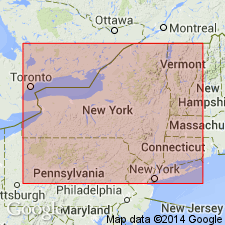
- Areal extent
- AAPG geologic province:
-
- New England province
Summary:
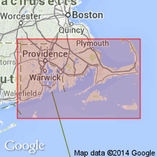
Montauk till member of Manhasset formation is present on Block, Nantucket, Martha's Vineyard, No Mans Land, and probably Cape Cod.
Source: GNU records (USGS DDS-6; Reston GNULEX).

- Usage in publication:
-
- Montauk till member
- Modifications:
-
- Age modified
- AAPG geologic province:
-
- Atlantic Coast basin
Summary:
Manhasset here regarded as Wisconsinan age.
Source: GNU records (USGS DDS-6; Reston GNULEX).
- Usage in publication:
-
- Montauk Till Member
- Modifications:
-
- Age modified
- AAPG geologic province:
-
- New England province
Summary:
Montauk Till Member of Manhasset Formation on Long Island along with other lower tills may be Illinoian, not early Wisconsinan as previously thought. The Montauk was deposited during a full glaciation of New England that was at least as extensive as the late Wisconsinan advance of the Laurentide ice. Ice advances during the early Wisconsinan probably did not reach Long Island. The till member is compact, distinctly banded or laminated, locally contains clay beds and consists of a sandy to silty matrix containing abundant stones. In all places it is faulted and folded, which complicates the determination of its stratigraphic position relative to other sediments. Probably equivalent to Merrick Formation to the south. Overlies Gardiners Clay, which is here restricted to marine clay containing fossil assemblages that indicate sea-water temperatures somewhat warmer to somewhat cooler than present sea-water temperature off Long Island. Underlies late Wisconsinan drift.
Source: GNU records (USGS DDS-6; Reston GNULEX).
- Usage in publication:
-
- Montauk Till Member
- Modifications:
-
- Age modified
- AAPG geologic province:
-
- Atlantic Coast basin
Summary:
Authors review usage of Fuller (1914) who applied the name Manhasset with its three members (Hempstead, Montauk, and Herod) to the Columbia formation of Woodworth. Fuller classified this formation as being older than the Vineyard erosion interval and assigned the Manhasset to the Illinoian. This report assigns the Manhasset of Fuller (including debris flows) to the Kansan(?), and interprets its origin as deltaic, deposited in Lake Long Island dammed on the south in part by pre-Ronkonkoma terminal-moraine ridge. Manhasset is older than Gardiners Clay (Yarmouthian).
Source: GNU records (USGS DDS-6; Reston GNULEX).
For more information, please contact Nancy Stamm, Geologic Names Committee Secretary.
Asterisk (*) indicates published by U.S. Geological Survey authors.
"No current usage" (†) implies that a name has been abandoned or has fallen into disuse. Former usage and, if known, replacement name given in parentheses ( ).
Slash (/) indicates name conflicts with nomenclatural guidelines (CSN, 1933; ACSN, 1961, 1970; NACSN, 1983, 2005, 2021). May be explained within brackets ([ ]).