- Usage in publication:
-
- Monson Gneiss*
- Modifications:
-
- Revised
- Areal extent
- AAPG geologic province:
-
- New England province
Summary:
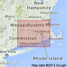
Hornblende-biotite-quartz-plagioclase gneiss in New London, CT, area previously called Monson Gneiss (Goldsmith, 1966) is here renamed Rope Ferry Gneiss, named for exposures between Rope Ferry Rd and Jordan Cove in town of Waterford. Use of name Monson Gneiss in southeastern CT is not warranted because the name was used for a specific rock type resembling only one of the group of related rock types in Bronson Hill anticlinorium collectively called Monson Gneiss. In addition, relative ages of Monson and Rope Ferry have been questioned by Naylor (1976) and Wintsch (1979).
Source: GNU records (USGS DDS-6; Reston GNULEX).

- Usage in publication:
-
- Monson Gneiss*
- Modifications:
-
- Overview
- AAPG geologic province:
-
- New England province
Summary:
Used as Monson Gneiss of Proterozoic Z, Cambrian, or Ordovician age. Consists of layered to massive biotite-plagioclase gneiss, amphibolite, and microcline augen gneiss. Amphibolite or lenses of variably altered peridotite separately mapped in places.
Source: GNU records (USGS DDS-6; Reston GNULEX).

- Usage in publication:
-
- Monson Gneiss*
- Modifications:
-
- Age modified
- AAPG geologic province:
-
- New England province
Summary:
Age of Monson Gneiss changed from Ordovician of Leo and others (1977) to Late Proterozoic, Cambrian, or Ordovician on basis of uncertainties similar to those regarding Fourmile Gneiss (Fourmile Gneiss is overlain with possible unconformity by either Ammonoosuc Volcanics or Partridge Formation). Unconformity between Monson and overlying Ammonoosuc is suggested by regional relations as well as by one conglomerate lens (Robinson, 1979) and two quartzite lenses (Robinson, unpub. data, 1983) where Ammonoosuc rests on Monson.
Source: GNU records (USGS DDS-6; Reston GNULEX).

- Usage in publication:
-
- Monson Gneiss
- Modifications:
-
- Geochronologic dating
- AAPG geologic province:
-
- New England province
Summary:
Swanzey, Pauchaug, Monson, and Fourmile Gneisses represent metamorphosed intrusive igneous rocks and yield ages from 454 to 442+3/-2 Ma. Therefore, ages range from early Late through latest Ordovician. Authors suggest that they represent the plutonic root of a calc-alkaline magmatic arc at least 250 km long that was produced partly or entirely on a continental margin in the Late Ordovician. The overlying Ammonoosuc Volcanics and Partridge Formation, rather that resting unconformably on these plagioclase-rich plutonic gneiss, are now known to have had a magmatic history overlapping with them and are approximately the same age.
Source: GNU records (USGS DDS-6; Reston GNULEX).

- Usage in publication:
-
- Monson Gneiss
- Modifications:
-
- Areal extent
- AAPG geologic province:
-
- New England province
Summary:
The name Monson Gneiss is restricted to the north-south trending outcrop belt that passes through Monson, MA. Hadlyme belt of Monson Gneiss (of Lundgren, 1966) here called North Plain lithofacies of newly defined Hadlyme Formation. Boulder Lake facies of Monson Gneiss (Lundgren and Thurrel, 1973), here named Boulder Lake Gneiss.
Source: GNU records (USGS DDS-6; Reston GNULEX).
For more information, please contact Nancy Stamm, Geologic Names Committee Secretary.
Asterisk (*) indicates published by U.S. Geological Survey authors.
"No current usage" (†) implies that a name has been abandoned or has fallen into disuse. Former usage and, if known, replacement name given in parentheses ( ).
Slash (/) indicates name conflicts with nomenclatural guidelines (CSN, 1933; ACSN, 1961, 1970; NACSN, 1983, 2005, 2021). May be explained within brackets ([ ]).

