- Usage in publication:
-
- Monocacy Member
- Modifications:
-
- Original reference
- Dominant lithology:
-
- Limestone
- Shale
- AAPG geologic province:
-
- Piedmont-Blue Ridge province
Summary:
Pg. 8 (fig. 4), 12-14, App. 1; see also Maryland Geol. Survey geol. maps of Buckeystown (Brezinski and Southworth, 2004), Frederick (Brezinski, 2004), Walkersville (Brezinski and others, 2004), and Woodsboro (Brezinski, 2004) 7.5-min quadrangles.
Monocacy Member of Frederick Formation. Knotty and brecciated limestones interbedded with intervals of dark-gray to black, calcareous shale. Shale up to 100+ feet (30+ m) thick in upper part serves as an excellent marker bed. Basal part is covered. Total thickness at type section 322 feet (98+ m). Overlies Araby Formation; underlies Rocky Springs Station Member (revised) of Frederick Formation. Has low relative karst suseptibility. Fossils; not well-preserved trilobites tentatively identified as Late Cambrian ACMARHACHIS sp. from black shale in upper part of member.
Rocks previously included in Cash Smith Formation (Edwards, 1988, Maryland Geol. Survey, geol. map Woodsboro quadrangle, scale 1:24,000) and Rocky Springs Station Member of Frederick Formation (Reinhardt, 1974, Maryland Geol. Survey Rpt. Inv., no. 23, 73 p.; Southworth and Brezinski, 2003, USGS Geol. Quad. Map GQ-1800, scale 1:24,000).
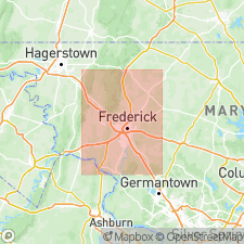
Type section (App. 1, loc. 5): along eastern bank of Monocacy River, near Frederick Municipal Airport, Walkersville 7.5-min quadrangle, Frederick Co., western MD; base of section approx. 500 yds north of I-70 bridge, Lat. 39 deg. 24 min. 52 sec. N., Long. 77 deg. 21 min. 46 sec. W., top of section on north side of airport near Clustered Spires Golf Course.
Source: Publication.
For more information, please contact Nancy Stamm, Geologic Names Committee Secretary.
Asterisk (*) indicates published by U.S. Geological Survey authors.
"No current usage" (†) implies that a name has been abandoned or has fallen into disuse. Former usage and, if known, replacement name given in parentheses ( ).
Slash (/) indicates name conflicts with nomenclatural guidelines (CSN, 1933; ACSN, 1961, 1970; NACSN, 1983, 2005, 2021). May be explained within brackets ([ ]).

