- Usage in publication:
-
- Monmouth formation
- Modifications:
-
- Named
- Dominant lithology:
-
- Sand
- Marl
- AAPG geologic province:
-
- Atlantic Coast basin
Summary:
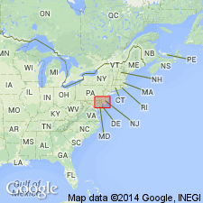
Name Monmouth formation proposed for unit which underlies Rancocas formation and overlies Matawan formation. Thickness ranges from 60 to 150 ft. Divided into (ascending) Mount Laurel sands, Navesink marls, and Redbank sands. Unit extends to DE and northeastern MD. Age is Late Cretaceous.
Source: GNU records (USGS DDS-6; Reston GNULEX).
- Usage in publication:
-
- Monmouth formation
- Modifications:
-
- Revised
- AAPG geologic province:
-
- Atlantic Coast basin
Summary:
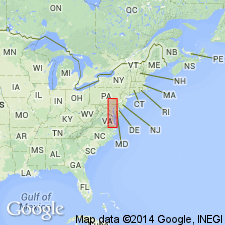
Unit is here considered of formational rank and, as defined in this report consists of beds lying below Hornerstown formation of Eocene age and above base of shell bed formed by EXOGYRA, GRYPHAEA, and BELEMNITELLA, which mark base of Navesink member. Includes also (ascending) Red Bank and Tinton members.
Source: GNU records (USGS DDS-6; Reston GNULEX).
- Usage in publication:
-
- Monmouth group
- Modifications:
-
- Areal extent
- AAPG geologic province:
-
- Atlantic Coast basin
Summary:
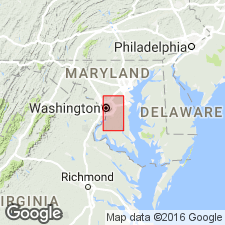
Late Cretaceous Monmouth Group described in Prince Georges Co. No complete section found; total thickness of outcropping Monmouth probably does not exceed 100 ft and may be as little as 40 or 50 ft. Presumably thicker in Prince Georges Co. than farther seaward. Dips toward southeast at estimated rate of 25 ft to the mile. Unconformably overlies Patapsco formation. Unconformably overlain by beds of Paleocene age or, more commonly, by Aquia greensand or by Miocene Chesapeake group. Extends southward across county from vicinity of Priest Bridge on Patuxent River to Fort Washington on Potomac River. Between Priest Bridge and Brightseat, outcrop forms a band 2 to 3 mi wide. Beyond Brightseat band is narrower, crooked and discontinuous.
Source: GNU records (USGS DDS-6; Reston GNULEX).
- Usage in publication:
-
- Monmouth Group*
- Modifications:
-
- Revised
- AAPG geologic province:
-
- Atlantic Coast basin
Summary:
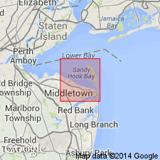
Tinton Sand Member of Red Bank Sand raised to formation rank. Monmouth Group now consists of (ascending) Mount Laurel Sand, Navesink Formation, Red Bank Sand, and Tinton Sand.
Source: GNU records (USGS DDS-6; Reston GNULEX).
- Usage in publication:
-
- Monmouth Formation*
- Modifications:
-
- Revised
- AAPG geologic province:
-
- Atlantic Coast basin
Summary:
In northeastern MD and northern DE of northernmost Delmarva Peninsula, the Upper Cretaceous terms Matawan and Monmouth Formation or Groups are not useful, and they should be restricted from the area in favor of other formations geographically extended from NJ. The Matawan Formation of northeastern MD (Kent and Cecil Cos.) is replaced by (ascending) Merchantville, Englishtown, and Marshalltown Formations, and the Monmouth Formation by the Mount Laurel Sand. The ascending Woodbury Clay, Wenonah, and Navesink Formations pinch out in NJ and are not present in DE and MD. [Although not stated in this report, Matawan Formation is recognized on the western shore and eastern shore of southern MD where the Merchantville, Englishtown, and Marshalltown cannot be recognized and extended into southern MD (N.F. Sohl, 1984, oral communication).]
Source: GNU records (USGS DDS-6; Reston GNULEX).
- Usage in publication:
-
- Monmouth Group*
- Modifications:
-
- Areal extent
- AAPG geologic province:
-
- Atlantic Coast basin
Summary:
Monmouth Formation is geographically restricted from MD. Its rocks now included in Severn Formation (now reinstated in northeastern MD and northern DE). Monmouth Group still used in NJ, NY, and PA.
Source: GNU records (USGS DDS-6; Reston GNULEX).
- Usage in publication:
-
- Monmouth Formation*
- Modifications:
-
- Areal extent
- AAPG geologic province:
-
- Atlantic Coast basin
Summary:
Monmouth Formation is used in Prince Georges Co., MD, and, by implication, in adjacent DC, following the usage of the Maryland Geological Survey. This map is based on the map of J.T. Hack, 1977, Geologic map for land-use planning, Prince Georges County, Maryland: USGS Miscellaneous Investigations Map I-1004, where Monmouth Group is used. [In Anne Arundel Co., MD, the Monmouth has been replaced by the Severn Formation (Minard and others, 1977), which also replaces certain correlative units on the eastern shore and DE, including the upper part of the Mount Laurel Sand, which replaced the Monmouth on the eastern shore in 1970 (Owens and others). Apparently the present USGS usage of Monmouth is: Group in NJ, PA, and NY; Formation in MD (Prince Georges Co.) and DC.]
Source: GNU records (USGS DDS-6; Reston GNULEX).
- Usage in publication:
-
- Monmouth Group*
- Modifications:
-
- Areal extent
- AAPG geologic province:
-
- Atlantic Coast basin
Summary:
It was assumed by Owens and Minard (1965) that of all the units in the Monmouth Group only the Mount Laurel is present in DE and MD. In Cecil Co., where the group is considerably thicker, some higher units of the Monmouth may exist. Therefore, in this report, unit is referred to as Monmouth Group in the belief that other members may overlie the Mount Laurel Sand. Beds of the Monmouth Group are exposed in many roadcuts and stream banks in southeastern part of Cecil Co. Along the DE state line these beds presumably lie immediately beneath the surficial Pensauken Formation from the south bank of Back Creek 1.5 mi south of the canal to the vicinity of Warwick. Elsewhere the Monmouth is overlain by the green Hornerstown. On the south bank of Back Creek, unit is about 30 ft thick. Thickness ranges to a maximum of 175 ft in power-auger hole on the Chesapeake and Delaware Canal. Abnormal thickness in western DE and in Cecil Co., MD, and presence of the ammonite SPHENODISCUS and other fossils in a dark-gray, very silty sand may indicate that the Red Bank Sand and Navesink Formation should be extended from NJ or that these previously unrecognized beds in MD and DE should be given new names. [This manuscript was reviewed by the GNU in 1973, but was not published until 1990. Field work for this study was done in the late 1960's. The nomenclature in this report may not reflect current USGS usage.]
Source: GNU records (USGS DDS-6; Reston GNULEX).
- Usage in publication:
-
- Monmouth Group
- Modifications:
-
- Areal extent
- AAPG geologic province:
-
- Atlantic Coast basin
Summary:
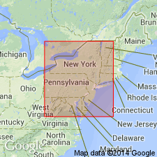
Report offers excellent overviews of the formations that compose the Monmouth Group in NJ (Mount Laurel, Navesink, Red Bank, Tinton, and New Egypt) including age, lithology, thickness, fauna, and areal extent of each. Map shows outcrop belt. The Monmouth overlies the Matawan Group and underlies the Rancocas Group. Age is Maastrichtian.
Source: GNU records (USGS DDS-6; Reston GNULEX).
- Usage in publication:
-
- Monmouth Group
- Modifications:
-
- Areal extent
- AAPG geologic province:
-
- Atlantic Coast basin
Summary:
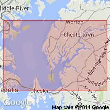
Two formations of Upper Cretaceous Monmouth Group occur in Ken-Bf 180, the Mount Laurel Formation and the Severn Formation. The Mount Laurel occupies the interval from 295 ft to 217.9 ft, while the Severn ranges from 217.9 to 204.2 ft. Biostratigraphic information from the core suggests that the Mount Laurel is Maastrichtian. Ostracode species recovered within the Severn at 210 ft range from late Campanian to Maastrichtian. Gradationally overlies the undivided Matawan Group and underlies the Hornerstown Formation.
Source: GNU records (USGS DDS-6; Reston GNULEX).
- Usage in publication:
-
- Monmouth Group*
- Modifications:
-
- Areal extent
- AAPG geologic province:
-
- Atlantic Coast basin
Summary:
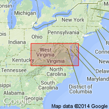
Late Cretaceous Monmouth Group used in MD
Source: GNU records (USGS DDS-6; Reston GNULEX).
For more information, please contact Nancy Stamm, Geologic Names Committee Secretary.
Asterisk (*) indicates published by U.S. Geological Survey authors.
"No current usage" (†) implies that a name has been abandoned or has fallen into disuse. Former usage and, if known, replacement name given in parentheses ( ).
Slash (/) indicates name conflicts with nomenclatural guidelines (CSN, 1933; ACSN, 1961, 1970; NACSN, 1983, 2005, 2021). May be explained within brackets ([ ]).

