The National Geologic Map Database is migrating to a new infrastructure. We apologize for any service disruptions during this process.
|
|---|


- Usage in publication:
-
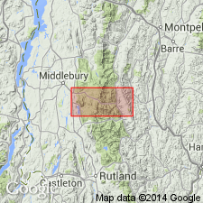
- Monastery formation
- Modifications:
-
- Named
- Dominant lithology:
-
- Schist
- Conglomerate
- Sandstone
- AAPG geologic province:
-
- New England province
Summary:
Monastery formation named in west-central VT for Monastery Mountain. Dominantly pale-green quartz-chlorite-muscovite schist. Basal conglomerate and schistose sandstone unit is Tyson member (new). Intermediate black graphitic quartz-muscovite schist is Battell member (new). Thickness of Monastery ranges from 1,400 to 1,700 ft. Overlies Mount Holly complex with no structural discontinuity; underlies Granville formation (new). Age is Early Cambrian.
Source: GNU records (USGS DDS-6; Reston GNULEX).
- Usage in publication:
-
- Monastery
- Modifications:
-
- Not used
- AAPG geologic province:
-
- New England province
Summary:
Osberg's Monastery formation not used on this State map. Strata included within the Underhill formation.
Source: GNU records (USGS DDS-6; Reston GNULEX).

- Usage in publication:
-
- Monastery Formation
- Modifications:
-
- Reinstated
- Revised
- Dominant lithology:
-
- Schist
- Greenstone
- AAPG geologic province:
-
- New England province
Summary:
T.R. Armstrong (in progress) uses the name Monastery Formation to describe albitic schist with fine grained metawacke and very minor conglomerate, quartz-muscovite-chlorite-albite-biotite schist, local lenses of dolarenitic schist, and local lenses of aluminous schist with garnet and chloritoid. The name is reinstated because the rocks are distinguishable from rocks in the Underhill and Fayston (new) Formations. In this report, the name Monastery is tentatively assigned to a group of distinctive, primarily nongraphitic rocks in Domain 4 and the western part of Domain 3. Consists of two map units: schist and greenstone. Battell Member of Osberg (1952) is removed from the Monastery and raised to Formation rank. [Tyson Member (of Osberg, 1952) is not used and there is no sandstone described as part of the Monastery in this area.] The Monastery is in gradational contact by intercalation with the White River Member (new) of the Battell Formation. The Monastery schists are also in gradational contact with the Fayston Formation (new) schists and in planar contact with the Underhill Formation along the west side.
Source: GNU records (USGS DDS-6; Reston GNULEX).
For more information, please contact Nancy Stamm, Geologic Names Committee Secretary.
Asterisk (*) indicates published by U.S. Geological Survey authors.
"No current usage" (†) implies that a name has been abandoned or has fallen into disuse. Former usage and, if known, replacement name given in parentheses ( ).
Slash (/) indicates name conflicts with nomenclatural guidelines (CSN, 1933; ACSN, 1961, 1970; NACSN, 1983, 2005, 2021). May be explained within brackets ([ ]).