

- Usage in publication:
-
- Mona schists*
- Modifications:
-
- Named
- Dominant lithology:
-
- Schist
- AAPG geologic province:
-
- Lake Superior region
Summary:
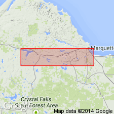
Archean nonconglomeratic greenstone-schists "are called the Mona schists, because good exposures are found on hills of this name southwest of Marquette," MI (Lake Superior region), secs 27 and 28, T48N, R25W. Formation is mapped (pl XIII) in east-west belt from Lake Superior west to about west line of R26W, where it is thought to pass into the Kitchi schists (new). Schist is highly variable: very fine grained and fissile; coarser grained and fibrous with distinct foliation; very coarse grained and fibrous with indistinct foliation; or dense and massive. Schistosity dips at high angles and strikes nearly east-west, about parallel to trend of Marquette trough. Rock types include aphanitic schist, banded schist, epidiorite, amphibolite, and crystalline schist. Aphanitic schist prevails in southern half of area --light green, fine grained; consists of granular epidote, small flakes and needles of chlorite and hornblende, and altered plagioclase, with calcite, leucoxene, minor quartz, and mosaic of albite or quartz. Banded schist prevails in northern half --alternate layers of darker and lighter shades of green give striped appearance, coarser grained than aphanitic schists, with abundant secondary amphibole, and fibrous. Schists are probably altered tuffs and squeezed basic lavas. Probably equivalent to Kitchi schists to the west. Considered pre-Algonkian.
Source: GNU records (USGS DDS-6; Denver GNULEX).
- Usage in publication:
-
- Mona Schist*
- Modifications:
-
- Revised
- AAPG geologic province:
-
- Lake Superior region
- Wisconsin arch
Summary:
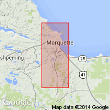
Pg. 7-18. Mona Schist. A metavolcanic rock present in Marquette 7.5-min quadrangle, Marquette County, northwestern Michigan (Lake Superior region). Divided into (ascending): informal lower member (= massive aphanitic greenstones of Williams, 1891, USGS Bull. 62), thickness 8,200 to 11,800 feet; and Lighthouse Point Member (new; = Eureka series and banded greenstones of Williams), thickness approximately 4,500 to 11,600(?) feet. Formation consists predominantly of ellipsoidal and other massive metabasalts and of layered amphibole schist. Chloritic, actinolitic, and quartz-sericite schists and slates and mafic meta-agglomerate make up lesser parts. Intruded by Compeau Creek Gneiss. Lower part of Mona metamorphosed to lower greenschist facies (chlorite zone); the gneiss reached amphibolite faces; upper part of Mona (between lower Mona and gneiss) is at an intermediate level between greenschist and amphibolite facies. Age is early Precambrian; rocks are oldest in area. Report includes geologic maps, correlation chart, mineralogic analyses.
Mona Schist and Compeau Creek Gneiss separated from metasedimentary Proterozoic rocks by major unconformity. Geologic map, correlation chart, mineralogic data, and detailed lithology included.
Source: Publication; Changes in stratigraphic nomenclature, 1968 (USGS Bull. 1294-A, p. A12).
- Usage in publication:
-
- Mona Schist*
- Modifications:
-
- Revised
- AAPG geologic province:
-
- Wisconsin arch
Summary:
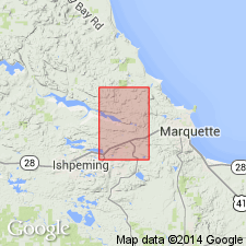
Revised to include (in ascending order): lower member of Gair and Thaden (1968) (informal), Nealy Creek Member (new), sheared rhyolite tuff member (informal), and Lighthouse Point Member in Negaunee quad, Marquette Co, northern MI in Lake Superior region. Undifferentiated greenstone is also mapped with Mona Schist in an area south of Carp River Falls shear zone. Sheared rhyolite tuff member contains pink to greenish-gray, felsic and quartz-rich metavolcanic rocks with tabular fragments 0.5-5 in thick. Tuff member is bounded on north and south by faults of large displacement and is 300-3,000 ft thick. Total thickness of Mona estimated at 24,000 ft but is complicated by intrusion of Dead River pluton, by broad zone of shearing across Dead River basin, and by syncline in Lighthouse Point Member north of Dead River basin. Probably overlies and is younger than Kitchi Schist and is intruded by both Compeau Creek Gneiss and Dead River pluton. Unconformably overlain by rocks of middle Precambrian age (Proterozoic) on north limb of Eagle Mills syncline and on north side of Dead River basin. Geologic map, stratigraphic nomenclature chart, chemical analyses given. Age is early Precambrian.
Source: GNU records (USGS DDS-6; Reston GNULEX).

- Usage in publication:
-
- Mona Schist*
- Modifications:
-
- Overview
- AAPG geologic province:
-
- Lake Superior region
Summary:
Is part of Superior province greenstone-granite terrane in Marquette district, northern MI in Lake Superior region. Is a sequence of [metamorphosed] mafic flows with iron-formation [unranked term] near the top. Overlies Kitchi Schist. Intruded and metamorphosed by Compeau Creek Gneiss and by other unnamed plutons. Correlation chart. Is Late Archean in age.
Source: GNU records (USGS DDS-6; Denver GNULEX).
- Usage in publication:
-
- Mona Schist*
- Modifications:
-
- Areal extent
- Revised
- AAPG geologic province:
-
- Wisconsin arch
Summary:
Mona Schist here restricted to block south of the Dead River shear zone. Includes rocks previously mapped as Lighthouse Point Member. Lighthouse Point Member of Mona Schist revised as Lighthouse Point Basalt and now stratigraphically extended to include all mafic rocks except gabbro in the lithostratigraphic block north of the Dead River shear zone. Status of Nealy Creek Member not discussed.
Source: GNU records (USGS DDS-6; Reston GNULEX).
- Usage in publication:
-
- Mona Formation*
- Modifications:
-
- Revised
- AAPG geologic province:
-
- Michigan basin
Summary:
Mona Schist is here revised to Mona Formation "because many rocks within the unit are not schists and because they have recognizable parent lithologies and are heterogeneous." It is also proposed that all members of the Mona be informal. Basal unit is here called the basalt flow unit of the Mona Formation; the sheared rhyolite tuff is called the lapilli tuff of the Mona Formation, and the Nealy Creek Member is here called the upper tuff of the Mona Formation.
Source: GNU records (USGS DDS-6; Reston GNULEX).
For more information, please contact Nancy Stamm, Geologic Names Committee Secretary.
Asterisk (*) indicates published by U.S. Geological Survey authors.
"No current usage" (†) implies that a name has been abandoned or has fallen into disuse. Former usage and, if known, replacement name given in parentheses ( ).
Slash (/) indicates name conflicts with nomenclatural guidelines (CSN, 1933; ACSN, 1961, 1970; NACSN, 1983, 2005, 2021). May be explained within brackets ([ ]).