

- Usage in publication:
-
- Mokuone formation
- Modifications:
-
- First used
- AAPG geologic province:
-
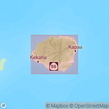
- Kauai
Summary:
Sedimentary rocks interbedded with Makaweli formation (of Waimea Canyon volcanic series) are known as Mokuone formation. [will be formally named in Bulletin 13 of Hawaii Division of Hydrography]
Source: GNU records (USGS DDS-6; Menlo GNULEX).
- Usage in publication:
-
- Mokuone member
- Modifications:
-
- Age modified
- AAPG geologic province:
-
- Kauai
Summary:
Crops out in narrow bands along Makaweli, Mokuone, Kahana, and Waimea canyons and their tributaries in SW part of Island of Kauai. No fossils. Later than Napali formation. Same in age as associated Makaweli formation and upper part of Olokele formation. Age is Pliocene(?).
Source: GNU records (USGS DDS-6; Menlo GNULEX).
- Usage in publication:
-
- Mokuone member*
- Modifications:
-
- Named
- Dominant lithology:
-
- Breccia
- Conglomerate
- AAPG geologic province:
-
- Kauai
Summary:
Named for Mokuone Valley. Type locality in Mokuone Valley [22 deg 00' 34"N, 159 deg 37' 51"W, Waimea Canyon 7.5' quad] Island of Kauai. Is member of Makaweli formation. Rocks formerly known as Mokuone formation (Macdonald, Davis and Cox, 1965). Map shows unit along Mokuone, Makaweli, Kahana and Waimea canyons. Composed of sedimentary breccia and conglomerate beds intercalated with Makaweli. Is about 1000 ft thick at end of spur below Puu Ka Pele. Age of Mokuone member is same as that of Makaweli formation [thus Pliocene].
Source: GNU records (USGS DDS-6; Menlo GNULEX).

- Usage in publication:
-
- Mokuone Breccia Beds*
- Modifications:
-
- Revised
- AAPG geologic province:
-
- Kauai
Summary:
Mokuone Member of Macdonald, Davis and Cox (1960) reduced in rank and renamed Mokuone Breccia Beds in Makaweli Member of Waimea Canyon Basalt. Assigned Pliocene age.
Source: GNU records (USGS DDS-6; Menlo GNULEX).
For more information, please contact Nancy Stamm, Geologic Names Committee Secretary.
Asterisk (*) indicates published by U.S. Geological Survey authors.
"No current usage" (†) implies that a name has been abandoned or has fallen into disuse. Former usage and, if known, replacement name given in parentheses ( ).
Slash (/) indicates name conflicts with nomenclatural guidelines (CSN, 1933; ACSN, 1961, 1970; NACSN, 1983, 2005, 2021). May be explained within brackets ([ ]).