

- Usage in publication:
-
- Mogollon Rim formation
- Modifications:
-
- Named
- Geochronologic dating
- Reference
- Dominant lithology:
-
- Gravel
- Mudstone
- Sandstone
- AAPG geologic province:
-
- Black Mesa basin
- Plateau sedimentary province
Summary:
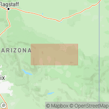
Named as an informal unit for gravels found on south side of the southeast part of Mogollon Rim of east-central AZ. Type section designated at Trout Creek in Navajo Co, AZ in the Black Mesa basin. Trout Creek is northeast of town of Whiteriver. Reference sections designated at Round Top and Deep Creek which lie between Whiteriver and the type section. Locality map indicates presence of formation to south in Gila Co Basin-and-Range province, to west in southern Navajo Co, Black Mesa basin and farther west in Coconino Co in Plateau sedimentary province. Cross sections. Is 375 m thick at type where it has been divided into 3 members and where it unconformably overlies Cretaceous sandstone and unconformably underlies Datil Group equivalents. Upper contact placed at base of first sandstone or conglomerate that has 50+ percent volcanic clasts. At type: lower member is a clast-supported gravel and conglomeratic sandstone; middle member is cyclic firing upward sequences of sandstone and mudstone, some gravel; upper member is mostly conglomeratic sandstone that is tuffaceous in upper part. Conglomeratic clast size and abundance decrease above the lower member. Gravel occurs at all sites examined but proportion varies. Between 80 and 99 percent of clast types are limestone, chert, quartzite, granitoids, volcanic porphyry, diabase, and metavolcanics. Argillite, quartz, greenstone, schist, tuff, sandstone, aphyric volcanics are minor clast types. Provenance and paleocurrent studies indicate 3 trunk streams. Is an alluvial braidplain deposit that covered the southern Colorado Plateau and Transition Zone in east-central AZ in Eocene time. Age of lowest part not well documented. A biotite airfall tuff interbedded with the formation 337 m above its base at type yielded K-Ar age of 37.6+/-0.8 m.y. A biotite tuff at Deep Creek in a similar stratigraphic position dated as 37.5 +/-0.8 m.y. Correlated with Eagar and Baca Formations of east AZ and west-central NM. Formerly called "Rim gravels" and "Transition zone gravels."
Source: GNU records (USGS DDS-6; Denver GNULEX).
For more information, please contact Nancy Stamm, Geologic Names Committee Secretary.
Asterisk (*) indicates published by U.S. Geological Survey authors.
"No current usage" (†) implies that a name has been abandoned or has fallen into disuse. Former usage and, if known, replacement name given in parentheses ( ).
Slash (/) indicates name conflicts with nomenclatural guidelines (CSN, 1933; ACSN, 1961, 1970; NACSN, 1983, 2005, 2021). May be explained within brackets ([ ]).