

- Usage in publication:
-
- Mogollon Andesite*
- Modifications:
-
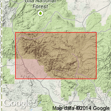
- Mapped 1:62.5k
- Dominant lithology:
-
- Andesite
- AAPG geologic province:
-
- Basin-and-Range province
Summary:
Is formation mapped undivided with other andesitic and latitic units in the vicinity of Bursum caldera in southern Catron Co, NM and in vicinity of Gila Cliff Dwellings caldera in southern Catron and northern Grant Cos, NM (Basin-and-Range province). Map unit: (Tya), younger andesitic and latitic lava flows (Miocene and Miocene?)--includes the Bearwallow Mountain Formation and Wall Lake Latite of Elston and others (1968), Double Springs Andesite of Elston, Coney, and Rhodes (1970), and Mogollon and Last Chance Andesites of the Mogollon mining district (Ferguson, 1927). Lithologic description not given.
Source: GNU records (USGS DDS-6; Denver GNULEX).
- Usage in publication:
-
- Mogollon Andesite†
- Modifications:
-
- Abandoned
Summary:
Mogollon Andesite is abandoned; rocks previously assigned to the unit are included in the Last Chance Andesite in the Mogollon mining district, Catron Co, NM (Basin-and-Range province). Discussion (p 58) as follows: "the Fanney Rhyolite can be seen to intrude its own early pyroclastic deposits, which also were mapped as Deadwood Gulch Rhyolite Tuff by Ferguson (1927) and Coney (1976, p. 30, fig. 1). It is now clear that the Deadwood Gulch is essentially the same as the Fanney Rhyolite ... and that where andesite flows underlie Deadwood Gulch they are Mineral Creek Andesite, not Last Chance Andesite as defined by Ferguson (1927, pls. 1, 2, p. 12-19). The Deadwood Gulch Tuff is here reduced in rank and assigned to the Fanney Rhyolite as a pyroclastic member, the Deadwood Gulch Member. The Last chance Rhyolite overlies both Fanney and Deadwood Gulch. The Mogollon Andesite, previously defined by Ferguson (1927, p. 19-21) as occurring between the Deadwood Gulch Member and the Dog Gulch Formation, is here abandoned, thus simplifying the volcanic section in the Mogollon district. Andesite dated as 25.0 m.y. old by Simpson and Strangway (1970) and Strangway, Simpson, and York (1976, p. 123) is Mineral Creek Andesite, not Last Chance Andesite as mapped by Ferguson although both andesites are Miocene in age."
Source: GNU records (USGS DDS-6; Denver GNULEX).
For more information, please contact Nancy Stamm, Geologic Names Committee Secretary.
Asterisk (*) indicates published by U.S. Geological Survey authors.
"No current usage" (†) implies that a name has been abandoned or has fallen into disuse. Former usage and, if known, replacement name given in parentheses ( ).
Slash (/) indicates name conflicts with nomenclatural guidelines (CSN, 1933; ACSN, 1961, 1970; NACSN, 1983, 2005, 2021). May be explained within brackets ([ ]).