The National Geologic Map Database is migrating to a new infrastructure. We apologize for any service disruptions during this process.
|
|---|


- Usage in publication:
-
- Modoc limestone*
- Modifications:
-
- Named
- Biostratigraphic dating
- Dominant lithology:
-
- Limestone
- Quartzite
- Dolomite
- AAPG geologic province:
-
- Basin-and-Range province
Summary:
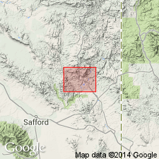
Named presumably for Modoc Mountain near Morenci, Greenlee Co, AZ in Basin-and-Range province. No type locality designated. Occurs locally in the southern two-thirds of the Clifton quad, AZ. Rocks equivalent to Modoc are in the lower part of Tule Spring limestone. Overlies the Morenci formation (Devonian?). Dominantly gray, cliff-forming limestone. Some white or reddish calcareous quartzite and dolomite. Two measured sections. Petrologic analyses. Geologic map. About 170 ft thick. Fossils (corals, brachiopods) indicate an Early Carboniferous (Mississippian) age.
Source: GNU records (USGS DDS-6; Denver GNULEX).
For more information, please contact Nancy Stamm, Geologic Names Committee Secretary.
Asterisk (*) indicates published by U.S. Geological Survey authors.
"No current usage" (†) implies that a name has been abandoned or has fallen into disuse. Former usage and, if known, replacement name given in parentheses ( ).
Slash (/) indicates name conflicts with nomenclatural guidelines (CSN, 1933; ACSN, 1961, 1970; NACSN, 1983, 2005, 2021). May be explained within brackets ([ ]).