


- Usage in publication:
-
- Modesto formation
- Modifications:
-
- Original reference
- Dominant lithology:
-
- Shale
- Sandstone
- Limestone
- Coal
- AAPG geologic province:
-
- Illinois basin
Summary:
Pg. 8 (fig. 1), 26 (fig. 4), 27, 36-38, 48-50 (table 1), pl. 1, geol. sections. Modesto formation of McLeansboro Group. Includes all strata from top of Danville (No. 7) coal member of Carbondale formation to base of Shoal Creek limestone member of Bond formation (new). Predominantly gray shales with sandstones locally prominent. Commonly about 300 feet thick; maximum thickness more than 400 feet in southeastern part of state; about 200 feet thick in local occurrences in northern Illinois. Age is Pennsylvanian. Presentation of new rock-stratigraphic classification of Pennsylvanian strata in Illinois. Cyclical classification is retained but is entirely independent of rock-stratigraphic classification.
Members (ascending): (1) southeastern Illinois, Piasa limestone, De Graff coal (new), Pond Creek coal (new), Lake Creek coal (new), West Franklin limestone, Trivoli sandstone, Chapel (No. 8) coal, and New Haven coal; (2) southwestern Illinois, Piasa limestone, Rock Branch coal (new), Athensville coal (new), Scottville limestone, Trivoli sandstone, Chapel (No. 8) coal, Carlinville limestone, Burroughs limestone, Womac coal (new), Macoupin limestone, and New Haven coal; (3) western and northern Illinois, Farmington shale, Gimlet sandstone, Lonsdale limestone, Exline limestone, Trivoli sandstone, Chapel (No. 8) coal, and Cramer limestone (new); and (4) eastern Illinois, Chapel (No. 8) coal and West Franklin limestone.
Type locality: in secs. 16 and 17, T. 12 N., R. 9 W., Macoupin Co., west-central IL. Named from town of Modesto.
Source: US geologic names lexicon (USGS Bull. 1200, p. 2540-2541).

- Usage in publication:
-
- Modesto Formation
- Modifications:
-
- Overview
- Age modified
- AAPG geologic province:
-
- Illinois basin
Summary:
Modesto Formation of McLeansboro Group includes all strata from top of Danville (No. 7) Coal Member of underlying Carbondale Formation to base of either Shoal Creek Limestone Member or LaSalle Limestone Member of overlying Bond Formation. Correlates with Shelburn Formation and overlying Patoka Formation of IN, and with a portion of Sturgis Formation of western KY. All members well described in report. Desmoinesian-Missourian boundary occurs at boundary between Trivoli Sandstone Member and overlying Chapel (No. 8) Coal Member.
Source: GNU records (USGS DDS-6; Reston GNULEX).
- Usage in publication:
-
- Modesto Formation
- Modifications:
-
- Areal extent
- AAPG geologic province:
-
- Illinois basin
Summary:
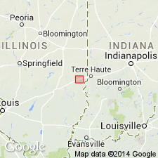
Modesto Formation of McLeansboro Group is generally composed of a series of partial cyclothemic sequences dominated by gray shale and less sandstone, claystone, siltstone, limestone, and coal. Regionally the Modesto is about 200 ft thick, but at the Martinsville site it reaches a maximum thickness of 165 ft. Members in the study area include (ascending) West Franklin Limestone, Chapel (No. 8) Coal, Inglefield Sandstone, Womac Coal, and Macoupin Limestone(?). The West Franklin and Chapel serve as marker beds. Underlies the Bond Formation and overlies the Carbondale Formation.
Source: GNU records (USGS DDS-6; Reston GNULEX).

- Usage in publication:
-
- Modesto Formation*
- Modifications:
-
- Areal extent
- AAPG geologic province:
-
- Illinois basin
Summary:
Used as Middle and Upper Pennsylvanian (upper Desmoinesian and lower Missourian) Modesto Formation of McLeansboro Group. Shown in IL only.
Source: GNU records (USGS DDS-6; Reston GNULEX).
For more information, please contact Nancy Stamm, Geologic Names Committee Secretary.
Asterisk (*) indicates published by U.S. Geological Survey authors.
"No current usage" (†) implies that a name has been abandoned or has fallen into disuse. Former usage and, if known, replacement name given in parentheses ( ).
Slash (/) indicates name conflicts with nomenclatural guidelines (CSN, 1933; ACSN, 1961, 1970; NACSN, 1983, 2005, 2021). May be explained within brackets ([ ]).