

- Usage in publication:
-
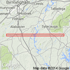
- Mitchell Dam Amphibolite
- Modifications:
-
- Named
- Dominant lithology:
-
- Amphibolite
- AAPG geologic province:
-
- Piedmont-Blue Ridge province
Summary:
Mitchell Dam Amphibolite named in Chilton Co., central AL. Unit is dark-green to brown, layered, and coarse to fine-grained. Age is middle Paleozoic.
Source: GNU records (USGS DDS-6; Reston GNULEX).
- Usage in publication:
-
- Mitchell Dam Amphibolite
- Modifications:
-
- Revised
- AAPG geologic province:
-
- Piedmont-Blue Ridge province
Summary:
Mitchell Dam Amphibolite assigned to Higgins Ferry Group. Inferred age of late Precambrian is assigned to the amphibolite units of the Coosa block, which includes the Mitchell Dam. They are surrounded by and intercalated with metasedimentary schists and gneisses of the Higgins Ferry Group. The Higgins Ferry overlies the Hatchet Creek Group and underlies the Wedowee Group.
Source: GNU records (USGS DDS-6; Reston GNULEX).

- Usage in publication:
-
- Mitchell Dam Amphibolite
- Modifications:
-
- Overview
- AAPG geologic province:
-
- Piedmont-Blue Ridge province
Summary:
Mitchell Dam Amphibolite is described as a dark-green to black, fine- to coarse-grained, thin-layered to massive hornblende-actinolite amphibolte with locally abundant chlorite and biotite. Plagioclase, quartz and clinozoisite are common accessory minerals. All thin amphibolites associated with the Higgins Ferry are included in the Mitchell Dam. Age listed as Precambrian to Paleozoic.
Source: GNU records (USGS DDS-6; Reston GNULEX).
For more information, please contact Nancy Stamm, Geologic Names Committee Secretary.
Asterisk (*) indicates published by U.S. Geological Survey authors.
"No current usage" (†) implies that a name has been abandoned or has fallen into disuse. Former usage and, if known, replacement name given in parentheses ( ).
Slash (/) indicates name conflicts with nomenclatural guidelines (CSN, 1933; ACSN, 1961, 1970; NACSN, 1983, 2005, 2021). May be explained within brackets ([ ]).