

- Usage in publication:
-
- Missouri Ridge Formation*
- Modifications:
-
- [Principal reference]
- Dominant lithology:
-
- Metasiltite
- Marble
- AAPG geologic province:
-
- Idaho Mountains province
Summary:
Pgs. 4 (fig. A3), 9 (fig. A5), 10 (fig. A6), 13, 60, pl. 2 (geologic map). Missouri Ridge Formation of Windermere Supergroup. [See also entry under Windermere.] Carbonaceous metasiltite and thinly layered calc-silicate-bearing marble in 5- to 15-m-thick [16+ to 49+ feet-thick] compositional zones. Estimated total thickness about 450 m [1,475+ feet]. Overlies Moores Lake Formation (new) of Windermere Supergroup; contact is narrow gradational zone of calc-silicate-dominant metasiltites. Unconformably(?) underlies Umbrella Butte Formation (new) of Windermere Supergroup. Age is Neoproterozoic.
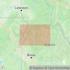
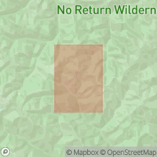
Type section: exposures on Missouri Ridge in northern Stibnite roof pendant, northwest corner Stibnite 7.5-min quadrangle, [Payette National Forest], west-central ID (Lund, 2004, fig. A6, loc. 5).
Named from Missouri Ridge, [in S/2 sec. 9, T. 19 N., R. 9E., approx. Lat. 44 deg. 59 min. 45 sec. N., Long. 115 deg. 21 min. 56 sec. W.], northwest corner Stibnite 7.5-min quadrangle, [Payette National Forest], west-central ID (Lund, 2004).
[Additional locality information from USGS historical topographic map collection TopoView and USGS GNIS database, accessed January 31, 2025.]
Source: Publication.
- Usage in publication:
-
- Missouri Ridge Formation
- Modifications:
-
- Not used
- AAPG geologic province:
-
- Idaho Mountains province
Summary:
Missouri Ridge Formation of Windermere Supergroup (Lund, 2004) not used in geologic map of Stibnite 7.5-min quadrangle. Rocks reallocated to informal map units (descending): unnamed Cambrian or Ordovician(?) middle marble; Neoproterozoic Fern marble of Smitherman (1985 Univ. Idaho MS thesis) in Windermere(?) Supergroup; unnamed Neoproterozoic lower calc-silicate in Windermere(?) Supergroup.
Source: Publication.
For more information, please contact Nancy Stamm, Geologic Names Committee Secretary.
Asterisk (*) indicates published by U.S. Geological Survey authors.
"No current usage" (†) implies that a name has been abandoned or has fallen into disuse. Former usage and, if known, replacement name given in parentheses ( ).
Slash (/) indicates name conflicts with nomenclatural guidelines (CSN, 1933; ACSN, 1961, 1970; NACSN, 1983, 2005, 2021). May be explained within brackets ([ ]).