The National Geologic Map Database is migrating to a new infrastructure. We apologize for any service disruptions during this process.
|
|---|


- Usage in publication:
-
- Missisquoi schists
- Modifications:
-
- Original reference
- AAPG geologic province:
-
- New England province
Summary:
Pg. 120-140, in a description of Roxbury, southern part of Washington Co., VT. Missisquoi schists. No definite name has been applied hitherto to the sericite schist, save describing them as sericite schists and quartz sericite schists. Author proposes Missisquoi schists for this terrane, which is prevailing schist in Missisquoi River valley in northern part of State [in Orleans County]. It is the schist in which most if not all serpentine and talc beds occur on east side of Green Mountains. Is certainly pre-Ordovician and tentatively referred to Lower Cambrian.
Source: US geologic names lexicon (USGS Bull. 896, p. 1386-1387).
- Usage in publication:
-
- Missisquoi schists
- Modifications:
-
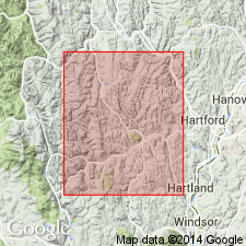
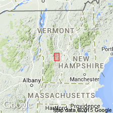
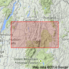
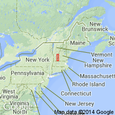
- Areal extent
- AAPG geologic province:
-
- New England province
Summary:
In description of Braintree Twp. Missisquoi schists. The sericite schist and quartz sericite schist are known as Missisquoi schists. They are continuous from Missisquoi Valley southward for more than 100 miles.
Source: US geologic names lexicon (USGS Bull. 896, p. 1386-1387).
- Usage in publication:
-
- Missisquoi group
- Modifications:
-
- Revised
- Age modified
- AAPG geologic province:
-
- New England province
Summary:
Pg. 109-140, in description of Randolph Twp., southwestern part of Orange Co., northeastern VT. Missisquoi group as here used is made to include the sericite schists, quartzite, and the chlorite schists that are of sedimentary origin; some of chlorite schists may be igneous. All terranes of the group are Cambrian, or at least they are pre-Ordovician.
Source: US geologic names lexicon (USGS Bull. 896, p. 1386-1387).
- Usage in publication:
-
- Missisquoi group
- Modifications:
-
- Age modified
- AAPG geologic province:
-
- New England province
Summary:
Pg. 77-103, in description of Bethel Twp., northwest part of Windsor Co., VT. Missisquoi group. No fossils, but unquestionably pre-Ordovician. Includes hornblende schists that may be of sedimentary origin; certain chlorite schists that seem to be of same age as enclosing sericites and quartzites, i.e., Upper Cambrian; sericitic quartzites regarded as Upper Cambrian, which grade into sericite schists that are younger than Bethel schist and older than Ordovician; and, in places, a conglomerate that is regarded as a basal conglomerate, but if not basal then it is an intraformational conglomerate and the Mississquoi group of terranes might then be regarded as Lower Cambrian. Rests unconformably on Bethel schist (Lower Cambrian).
Source: US geologic names lexicon (USGS Bull. 896, p. 1386-1387).
- Usage in publication:
-
- Missisquoi group
- Modifications:
-
- Age modified
- AAPG geologic province:
-
- New England province
Summary:
Pg. 127-158, describing Barnard, Pomfret, and Woodstock Twps., in Windsor Co., southeastern VT. Missisquoi group. Sericite schists and sericite quartzites, with minor beds of chloritic schists, hornblende schist, and gneiss that may not in all cases be of sedimentary origin. Is youngest Late Cambrian terrane in eastern Vermont. Conformably overlies Bethel group.
Source: US geologic names lexicon (USGS Bull. 896, p. 1386-1387).
- Usage in publication:
-
- Missisquoi formation
- Modifications:
-
- Areal extent
- AAPG geologic province:
-
- New England province
Summary:
Pg. 31. Missisquoi formation. Stated that this Missisquoi formation was named for Missisquoi or Missisco River, which rises in town of Lowell [Irasburg quadrangle, Orleans County, Vermont], and flows northward into Canada, then swings south again into Vermont and empties into Lake Champlain in northwestern Vermont. The rocks on Missisquoi River in northwestern Vermont are not same as Missisquoi schist of Richardson of northeastern Vermont.
Source: US geologic names lexicon (USGS Bull. 896, p. 1386-1387).
- Usage in publication:
-
- Missisquoi group
- Modifications:
-
- Revised
- AAPG geologic province:
-
- New England province
Summary:
Missisquoi group. Gassetts schist is a new, and the oldest member of Missisquoi group, Upper Cambrian.
Source: US geologic names lexicon (USGS Bull. 896, p. 1386-1387).
- Usage in publication:
-
- Missisquoi Formation*
- Modifications:
-
- Age modified
- Geochronologic dating
- AAPG geologic province:
-
- New England province
Summary:
Shown on generalized geologic map as Cambrian and Ordovician. New U-Pb zircon data indicate the following ages for rocks in southeastern VT: 1) Barnard Volcanic Member of Missisquoi Formation, 418 +/-1 Ma (Silurian); a dike cutting Standing Pond Volcanics, 423 +/-4 Ma (Silurian) (or 421 +/-2 Ma using weighted average of Pb-Pb ages); and 3) Moretown Member of Missisquoi, no primary age obtained, but age of provenance(s) of sediments is Early to Middle Proterozoic (1.0 to 1.7 Ga). A fourth sample, thought to be from Barnard, yielded an Early Cambrian age; this leads to one of two possibilities: either the rock was not actually from Barnard as was thought, or the zircons were detrital or xenocrystic in origin. [No official age change in GNU records resulting from this report.]
Source: GNU records (USGS DDS-6; Reston GNULEX).

- Usage in publication:
-
- Missisquoi Formation*
- Modifications:
-
- Areal extent
- AAPG geologic province:
-
- New England province
Summary:
In Glens Falls quad, rocks of eastern Green Mountain terrane, east of Richardson Memorial Contact (an eastward-facing unconformity or possibly a tectonic contact) include the Hoosac, Pinney Hollow, Ottauquechee, and Stowe Formations (of probable Cambrian through Early Ordovician age), Moretown Formation (probably Ordovician), and Barnard Volcanic Member of Missisquoi Formation [unclear as to its stratigraphic position or age here]. West of Richardson Memorial Contact, rocks include conglomeratic units such as Tyson Formation as used by Doll and others (1961) [no age provided, but presumably Cambrian].
Source: GNU records (USGS DDS-6; Reston GNULEX).
For more information, please contact Nancy Stamm, Geologic Names Committee Secretary.
Asterisk (*) indicates published by U.S. Geological Survey authors.
"No current usage" (†) implies that a name has been abandoned or has fallen into disuse. Former usage and, if known, replacement name given in parentheses ( ).
Slash (/) indicates name conflicts with nomenclatural guidelines (CSN, 1933; ACSN, 1961, 1970; NACSN, 1983, 2005, 2021). May be explained within brackets ([ ]).