- Usage in publication:
-
- Mission sandstone*
- Modifications:
-
- Named
- Dominant lithology:
-
- Sandstone
- AAPG geologic province:
-
- Chautauqua platform
Summary:
Is a very conspicuous bed of hard, slabby weathering, pink sandstone, 2 to 4 feet thick. Fossil shells present in upper part. Overlain and underlain by unnamed shale. Forms the surface between the Caney River and Mission Creek. Less distinguishable to southeast where it merges with a sequence of lenticular sandstone. Age is Pennsylvanian. Report includes columnar section.
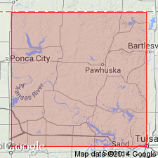
Type locality not designated. Named from occurrence along Mission Creek, in secs. 13, 14, 23, 24, and 25, T. 28 N., R. 11 E., Osage Co., OK on the Chautauqua platform.
Source: Modified from GNU records (USGS DDS-6; Denver GNULEX).
For more information, please contact Nancy Stamm, Geologic Names Committee Secretary.
Asterisk (*) indicates published by U.S. Geological Survey authors.
"No current usage" (†) implies that a name has been abandoned or has fallen into disuse. Former usage and, if known, replacement name given in parentheses ( ).
Slash (/) indicates name conflicts with nomenclatural guidelines (CSN, 1933; ACSN, 1961, 1970; NACSN, 1983, 2005, 2021). May be explained within brackets ([ ]).

