


- Usage in publication:
-
- Misener sand
- Modifications:
-
- Overview
- AAPG geologic province:
-
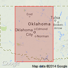
- Anadarko basin
- Chautauqua platform
Summary:
"A name that has been applied by drillers and oil geologists to a sand, or sands, encountered in oil and gas wells of many counties of eastern and northern Oklahoma, and Cowley and adjoining counties of southern Kansas [Anadarko basin and Chautauqua platform]. The name is said (N.W. Bass) to have been first applied to a sand in an oil pool near town of Beggs, Okmulgee County, Oklahoma. In that county (according to Oklahoma Geol. Survey Bull., no. 40F, 1926) it lies in top of Viola limestone; it is not a sheet sand, but consists of small lenses; it occurs locally; and it has been correlated with Sylamore sandstone. The sand, as now commonly interpreted, is a transgressing unit that is treated by the USGS as basal member of Chattanooga shale, and it overlies a widespread unconformity of pre-Chattanooga time. In some parts of Oklahoma, it lies on Siliceous lime (Arbuckle limestone); in other places it lies on rocks as young as Hunton limestone (Devonian and Silurian). It is said (N.W. Bass, letter) to have been named for Fred D. Misener, an oil operator of Tulsa, and to have been found at depths of 3,009 to 3,054 ft in No. 1 well (drilled between December 19, 1919, and March 10, 1920) on McWilliams lease in sec 23, T15N, R10E (now included in Wilcox oil pool, Creek Co, OK), where it rests on Viola limestone."
Source: GNU records (USGS DDS-6; Denver GNULEX).

- Usage in publication:
-
- Misener sand*
- Modifications:
-
- Areal extent
- AAPG geologic province:
-
- Anadarko basin
Summary:
Extended into the subsurface of Baca County, Colorado, in the Anadarko basin. An informal name commonly used by oil geologists for a fine-grained sandstone, and green, sandy, pyritic shale, about 6 feet thick. Overlies Viola limestone and underlies Gilmore City limestone. Report includes correlation chart.
Source: Modified from GNU records (USGS DDS-6; Denver GNULEX).
- Usage in publication:
-
- Misener Sandstone
- Modifications:
-
- Areal extent
- Biostratigraphic dating
- Overview
- Dominant lithology:
-
- Sandstone
- Dolomite
- AAPG geologic province:
-
- Anadarko basin
- Chautauqua platform
Summary:
Is a somewhat discontinuous subsurface sandstone-carbonate rock sequence that occurs in an extensive northwest-southeast-trending belt in north-central OK (Anadarko basin and Chautauqua platform). Unconformably overlies strata ranging (from west to east) in age from Early Devonian Frisco Formation to pre-Simpson Group Ordovician strata. Is overlain by Woodford Shale (Upper Devonian and Lower Mississippian); is locally interbedded with Woodford-type shale. Comprised mostly of rounded, detrital quartz grains (mostly 0.1-0.25 mm) cemented with crystalline dolomite and grades into crystalline dolomite with scattered quartz grains; bedding defined by dolomite-rich layers alternating with quartz-rich layers; some conglomeratic beds present; glauconite locally common; fossils include conodonts and brachiopods. Is less than 20 ft thick in most of study area, and only about 1 ft thick in many places; reported as thick as 70-100 ft in a few wells, but these are suspected stratigraphic misidentifications. Conodont zones identified in cores: POLYGNATHUS VARCUS Zone (upper Middle Devonian), lower and middle P. ASYMMETRICUS Zones (lower Upper Devonian), and upper PALMATODELLA TRIANGULARIS Zone (upper Upper Devonian). Faunal data implies that part of Misener is contemporaneous with much of the Woodford in southern OK, and is correlative with older part of type Sylamore Sandstone in northern AR. Nearshore marine deposit. Subsurface areal extent (fig 2).
Source: GNU records (USGS DDS-6; Denver GNULEX).
For more information, please contact Nancy Stamm, Geologic Names Committee Secretary.
Asterisk (*) indicates published by U.S. Geological Survey authors.
"No current usage" (†) implies that a name has been abandoned or has fallen into disuse. Former usage and, if known, replacement name given in parentheses ( ).
Slash (/) indicates name conflicts with nomenclatural guidelines (CSN, 1933; ACSN, 1961, 1970; NACSN, 1983, 2005, 2021). May be explained within brackets ([ ]).