

- Usage in publication:
-
- Miraleste tuff bed*
- Modifications:
-
- Named
- Dominant lithology:
-
- Tuff
- AAPG geologic province:
-
- Los Angeles basin
Summary:
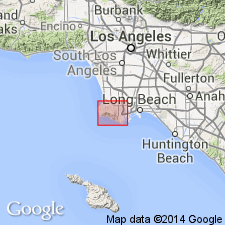
Named for Miraleste district. Type region [area] on W side of upper Agua Negra Canyon, Palos Verdes Hills [Torrance 7.5' quad, Los Angeles Co, CA]. Is bed in middle part of Altamira shale member of Monterey shale in Palos Verdes Hills. Consists of distinctive tuff readily recognized by abundance of pumice lapillae which lies 125 to 175 ft below top of middle part of Altamira shale member. Thickness from 2 to 6 ft but at places only few in. Traced S across crest of hills but toward W on S slope becomes bentonitic. Assigned middle Miocene based on Foraminifera and mollusks in middle part of Altamira shale member.
Source: GNU records (USGS DDS-6; Menlo GNULEX).
- Usage in publication:
-
- Miraleste tuff bed*
- Modifications:
-
- Overview
- AAPG geologic province:
-
- Los Angeles basin
Summary:
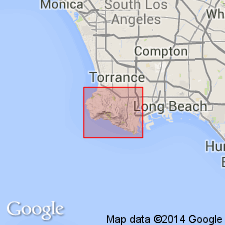
Included in measured section of middle part of Altamira shale member of Monterey shale on W side of Agua Negra Canyon. Consists of fine-grained massive tuff containing many fragments of dark-colored pumice having length of .5 in to 1.0 in; includes slabs of diatomite and limestone (up to 1 ft in length) lying in various attitudes. Locally matrix of tuff is calcified, forming hard limy bed speckled with pumice. Also recognized in George F. Canyon and San Pedro Canyon. Probable equivalent in E fork of Altamira Canyon. Shown on map of Palos Verdes Hills. Is middle Miocene based on age of Foraminifera (Luisian stage of Kleinpell) and mollusks from middle part of Altamira shale member.
Source: GNU records (USGS DDS-6; Menlo GNULEX).
- Usage in publication:
-
- Miraleste tuff bed*
- Modifications:
-
- Overview
- AAPG geologic province:
-
- Los Angeles basin
Summary:
Is lapilli tuff unit in tongue of diatomaceous shale of Monterey Shale. Restudy suggests unit is complex of tabular bodies approx. 1 mm to 3 m thick. Bodies occur at almost stratigraphic horizon through approx 10 km of exposure but in detail gently to sharply discordant. Tuff is pale greenish gray or pale greenish yellow, but its margins are pale yellowish orange. Is moderately cohesive. Many characteristics are best explained by assuming unit was injected as gas-mobilized debris into poorly consolidated sediments just beneath sea floor.
Source: GNU records (USGS DDS-6; Menlo GNULEX).
For more information, please contact Nancy Stamm, Geologic Names Committee Secretary.
Asterisk (*) indicates published by U.S. Geological Survey authors.
"No current usage" (†) implies that a name has been abandoned or has fallen into disuse. Former usage and, if known, replacement name given in parentheses ( ).
Slash (/) indicates name conflicts with nomenclatural guidelines (CSN, 1933; ACSN, 1961, 1970; NACSN, 1983, 2005, 2021). May be explained within brackets ([ ]).