

- Usage in publication:
-
- Mint Spring calcareous marl member*
- Modifications:
-
- Named
- Dominant lithology:
-
- Marl
- AAPG geologic province:
-
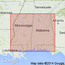
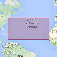
- Mid-Gulf Coast basin
Summary:
Mint Spring calcareous marl member named to include sands and shell marls, which in western MS replace "chimney rock" facies of Marianna limestone. Between Vicksburg and Pearl River, the Mint Spring occupies entire interval between Forest Hill sand below and Glendon limestone above, but east of Pearl River it is overlain by a thickening wedge of Marianna "Chimney rock." Unit has not been recognized east of Chickasawhay River. [Name was changed by the Geologic Names Committee in 1925 to Mint Spring marl member, as all marl is calcareous.]
Source: GNU records (USGS DDS-6; Reston GNULEX).
- Usage in publication:
-
- Mint Spring marl member
- Modifications:
-
- Revised
- AAPG geologic province:
-
- Mid-Gulf Coast basin
Summary:
Writers propose to set upper limit of the Mint Spring at first limestone ledge, and the lower at last fossiliferous bed. Between these limits are 20 to 25 ft of marine strata, grading from sparingly fossiliferous lignitic sands and clays in lower part to sandy fossiliferous marls in upper part.
Source: GNU records (USGS DDS-6; Reston GNULEX).
- Usage in publication:
-
- Mint Spring marl member*
- Modifications:
-
- Overview
- Areal extent
- AAPG geologic province:
-
- Mid-Gulf Coast basin
Summary:
Unit consists chiefly of fossiliferous sand, sandy marl with numerous limestone concretions, and more rarely, concretionary ledges. Maximum thickness about 25 ft. Overlies Forest Hill sand and, in AL, Red Bluff clay.
Source: GNU records (USGS DDS-6; Reston GNULEX).
- Usage in publication:
-
- Mint Spring marl member
- Modifications:
-
- Age modified
- AAPG geologic province:
-
- Mid-Gulf Coast basin
Cooke, C.W., 1945, Geology of Florida: Florida Geological Survey Bulletin, no. 29, 339 p.
Summary:
Age designation of Marianna limestone changed to middle Oligocene.
Source: GNU records (USGS DDS-6; Reston GNULEX).
- Usage in publication:
-
- Mint Spring Marl Member
- Modifications:
-
- Age modified
- AAPG geologic province:
-
- Mid-Gulf Coast basin
Summary:
Age of Vicksburg Group changed from middle Oligocene to early Oligocene. [Age of units within Vicksburg changed by inference.]
Source: GNU records (USGS DDS-6; Reston GNULEX).
- Usage in publication:
-
- Mint Spring Formation*
- Modifications:
-
- Revised
- AAPG geologic province:
-
- Mid-Gulf Coast basin
Summary:
Unit raised in rank from Mint Spring Marl Member of Marianna Limestone to Mint Spring Formation of Vicksburg Group. Overlies Forest Hill and Red Bluff Formations; underlies Marianna Formation of Vicksburg.
Source: GNU records (USGS DDS-6; Reston GNULEX).
- Usage in publication:
-
- Mint Spring Formation
- Modifications:
-
- Biostratigraphic dating
- AAPG geologic province:
-
- Mid-Gulf Coast basin
Summary:
Calcareous nannoplankton floras from the Mint Spring Formation and the Marianna Limestone indicate that these formations are diachronous along their outcrop belt in MS and southwest AL. In east-central MS and AL, these strata correlate to the ERICSONIA SUBDISTICHA Zone (NP21), while in west-central MS, they contain nannofossils of the younger HELICOSPHAERA RETICULATA Zone (NP22).
Source: GNU records (USGS DDS-6; Reston GNULEX).

- Usage in publication:
-
- Mint Spring Marl Member, Formation
- Modifications:
-
- Overview
- AAPG geologic province:
-
- Mid-Gulf Coast basin
Summary:
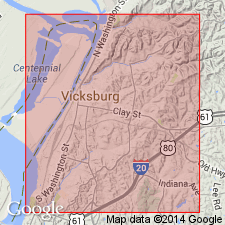
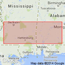
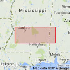
From St. Stephens westward into MS, the Mint Spring (Marl Member/Formation) is recognized at the base of the Marianna. At St. Stephens, the Mint Spring Marl Member consists of approximately 1.5 ft of yellowish-gray argillaceous, silty, glauconitic, pyritic, fossiliferous marl. The upper limestone facies of the Marianna thins and becomes more sandy and glauconitic into MS and the Mint Spring Formation, as it is called in MS, thickens. Along the Chickasawhay River, Wayne Co., MS, the Mint Spring, which ranges in thickness from approximately 1 ft to as much as 17 ft, consists primarily of dark-gray argillaceous to arenaceous, fossiliferous, glauconitic marl. In Smith Co., MS, the Mint Spring averages 12 ft in thickness and consists of greenish-gray fossiliferous, glauconitic, pyritic, sandy marl and greenish-gray medium- to coarse-grained, glauconitic, fossiliferous sand. On Mint Spring Bayou near Vicksburg, Warren Co., MS, the most western reported occurrence of the Marianna, the Mint Spring consists of 25 ft of glauconitic fossiliferous sand and marl that disconformably overlies the Forest Hill Sand, while the overlying Marianna is only 3 ft thick.
Source: GNU records (USGS DDS-6; Reston GNULEX).
For more information, please contact Nancy Stamm, Geologic Names Committee Secretary.
Asterisk (*) indicates published by U.S. Geological Survey authors.
"No current usage" (†) implies that a name has been abandoned or has fallen into disuse. Former usage and, if known, replacement name given in parentheses ( ).
Slash (/) indicates name conflicts with nomenclatural guidelines (CSN, 1933; ACSN, 1961, 1970; NACSN, 1983, 2005, 2021). May be explained within brackets ([ ]).