The National Geologic Map Database is migrating to a new infrastructure. We apologize for any service disruptions during this process.
|
|---|


- Usage in publication:
-
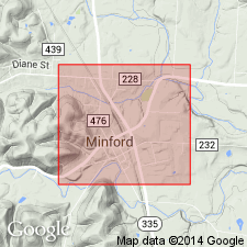
- Minford silts
- Modifications:
-
- Named
- Dominant lithology:
-
- Silt
- AAPG geologic province:
-
- Appalachian basin
Summary:
Fine, highly laminated silts, composing upper and by far greater part of valley filling of old preglacial valleys of all larger streams in southern OH and well toward headwaters of smaller tributaries here named Minford silts for exposure near town of that name in Scioto Co. Evidence favors a glacial origin. Rest on the old alluvium, where locally present, and on the still older sands that lie on bedrock.
Source: GNU records (USGS DDS-6; Reston GNULEX).
- Usage in publication:
-
- Minford silt*
- Modifications:
-
- Overview
- Areal extent
- AAPG geologic province:
-
- Appalachian basin
Summary:
Minford silt has a maximum thickness of more than 80 ft. Commonly rests on fine sand or sandy silt, which generally overlies the bedrock and which may represent part of original stream alluvium. Occurs in central Madison Co., northeast Clark Co., and southwestern Champaign Co. of west-central OH. Age is pre-Illinoian.
Source: GNU records (USGS DDS-6; Reston GNULEX).
- Usage in publication:
-
- Minford Clay, Clay Member
- Modifications:
-
- Revised
- Dominant lithology:
-
- Clay
- AAPG geologic province:
-
- Appalachian basin
Summary:
Unit referred to as Minford Clay, following the usage of Hoyer (1976: Ohio State Univ., Ph.D. thesis). In OH, the sand underlying the Minford is frequently referred to as the "Gallia Sand." [No references supplied for this term.] "Since both the Gallia Sand and the Minford Clay were deposited prior to or during the Lake Tight period in the Teays Valley, they are commonly grouped and classified as Teays Formation." 9.5 m of Minford examined in this study. Except for 13-cm loess cap, the entire section consisted of rhythmitic clays and silty clays with laminae ranging from 1 to 2 mm in thickness; sand content less than 0.2 percent.
Source: GNU records (USGS DDS-6; Reston GNULEX).
- Usage in publication:
-
- Minford Silt Member
- Modifications:
-
- Revised
- Overview
- AAPG geologic province:
-
- Appalachian basin
Summary:
Paleomagnetic and stratigraphic data indicate that the Minford Silt Member of the Teays Formation (formerly Teay Formation) was deposited during an early Pleistocene glaciation within the Matuyama reversed-polarity chron. Authors propose that the Minford was deposited between 0.79 and 0.88 Ma. Fullerton (1986: Quaternary Science Reviews, v. 5, p. 23-38) also placed the Minford and other members of the Teays Formation in the early Pleistocene. Study area is in an abandoned segment of the Teays River Valley at Teays Depot (38.44 deg N, 81.95 deg W), WV. Unit overlies the Gallia Sand Member of the Teays.
Source: GNU records (USGS DDS-6; Reston GNULEX).
For more information, please contact Nancy Stamm, Geologic Names Committee Secretary.
Asterisk (*) indicates published by U.S. Geological Survey authors.
"No current usage" (†) implies that a name has been abandoned or has fallen into disuse. Former usage and, if known, replacement name given in parentheses ( ).
Slash (/) indicates name conflicts with nomenclatural guidelines (CSN, 1933; ACSN, 1961, 1970; NACSN, 1983, 2005, 2021). May be explained within brackets ([ ]).