The National Geologic Map Database is migrating to a new infrastructure. We apologize for any service disruptions during this process.
|
|---|


- Usage in publication:
-
- Mimbres conglomerate
- Modifications:
-
- First used
- Dominant lithology:
-
- Sand
- Gravel
- Silt
- Clay
- Basalt
- AAPG geologic province:
-
- Basin-and-Range province
Summary:
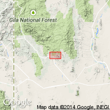
First use of name; shown on chart only. Origin of name not stated. Intent to name not stated and no type locality designated. Area of report is the Santa Rita quadrangle, Grant Co, NM in Basin-and-Range province. Unconformably underlies Pleistocene and Holocene alluvium; unconformably overlies Miocene? lava flows. Consists of consolidated and deformed sand, gravel, silt, and clay, with interbedded basalt flows in the desert flat south of the district, and north and east of the quadrangle. Is 1,000 +/-ft thick. Is of Miocene?-Pliocene age.
Source: GNU records (USGS DDS-6; Denver GNULEX).
- Usage in publication:
-
- Mimbres formation
- Modifications:
-
- Areal extent
- Revised
- Age modified
- AAPG geologic province:
-
- Basin-and-Range province
Summary:
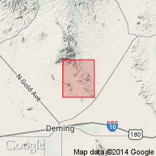
Mimbres revised in report area, Massacre quadrangle, Luna Co, NM, Basin-and-Range province--author proposes that unit be used informally as "Mimbres formation" and restricted to the closed Mimbres basin. [Clemons proposal is specifically contrary to the North American Stratigraphic Code (1983, Article 30, Remarks (h), p. 859) which states, "Geographic names should be combined with the terms "formation" or "group" only in formal nomenclature."] Name "Mimbres conglomerate" was introduced by Hernon and others (1953) but was later dropped in favor of either Gila Conglomerate or Santa Fe Group. On geologic map informal Mimbres is described as having two facies (descending): 1) a piedmont-slope facies; fan gravel and fanglomerate with interbedded sandy zones; includes thin erosion-surface veneers near mountain fronts; upper layers contain thick carbonate accumulations (caliche); thickness to 40 ft; Pleistocene age; and 2) a facies similar to the first, except it contains more intensely weathered boulders and thicker carbonate zones and is often preserved in higher level terrace remnants than those composed of first facies; Pliocene-Pleistocene age. This is an age modification--Hernon and others (1953) gave an age of Miocene?-Pliocene; author gives an age of Pliocene to Pleistocene. [Possibly this is also a lithologic redescription--original description was so sketchy, it's difficult to tell.] Geologic map.
Source: GNU records (USGS DDS-6; Denver GNULEX).
For more information, please contact Nancy Stamm, Geologic Names Committee Secretary.
Asterisk (*) indicates published by U.S. Geological Survey authors.
"No current usage" (†) implies that a name has been abandoned or has fallen into disuse. Former usage and, if known, replacement name given in parentheses ( ).
Slash (/) indicates name conflicts with nomenclatural guidelines (CSN, 1933; ACSN, 1961, 1970; NACSN, 1983, 2005, 2021). May be explained within brackets ([ ]).