The National Geologic Map Database is migrating to a new infrastructure. We apologize for any service disruptions during this process.
|
|---|


- Usage in publication:
-
- Millsap limestone*
- Modifications:
-
- Original reference
- Dominant lithology:
-
- Dolomite
- Sandstone
- AAPG geologic province:
-
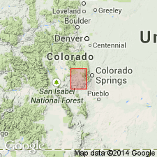
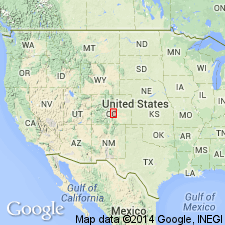
- Denver basin
Summary:
Millsap limestone. Remnants of thin-bedded, variegated, dolomitic limestone with a few thin sandstone layers. Chert nodules in upper layers carry characteristic Carboniferous fossils. Thickness 0 to 80 feet. Unconformably underlies Fountain formation, and unconformably overlies Fremont limestone.
Named from Millsap Creek, Pikes Peak quadrangle, [Fremont Co.], eastern CO.
Source: US geologic names lexicon (USGS Bull. 896, p. 1374).
- Usage in publication:
-
- Millsap limestone
- Modifications:
-
- Areal extent
- AAPG geologic province:
-
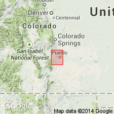
- Denver basin
Summary:
Millsap limestone. Coarse gray and red sandstone (30 feet thick) underlain by 200 feet of gray and purple limestones with some shale, especially in lower part. Assigned to Carboniferous. Underlies Fountain formation and conformably overlies Harding sandstone. Like the Harding, the limestones occupy 2 small areas west of Beulah, separated by St. Charles Canyon. A Carboniferous fossil was found near middle of the limestones, but nothing was found to mark presence of Fremont limestone, which in Pikes Peak district separates Millsap and Harding formations. Application of name Millsap to whole limestone series of Pueblo district is a somewhat arbitrary procedure and is subject to correction when more facts are available. Use of Millsap in Texas has priority, and if retained in Texas another name will have to be selected for this Colorado formation.
Source: US geologic names lexicon (USGS Bull. 896, p. 1374).
- Usage in publication:
-
- Millsap limestone†
- Modifications:
-
- Abandoned
- AAPG geologic province:
-
- Denver basin
Summary:
Pg. 381-396. Divided the beds beneath Fountain formation and above Manitou limestone on east slope of Front Range, Colorado (typical Millsap region) into Madison limestone (Mississippian) 100 feet, and Williams Canyon limestone (of supposed Devonian age) 30 feet, and reported an unconformity between the two. (See under Williams Canyon limestone.)
Source: US geologic names lexicon (USGS Bull. 896, p. 1374).
For more information, please contact Nancy Stamm, Geologic Names Committee Secretary.
Asterisk (*) indicates published by U.S. Geological Survey authors.
"No current usage" (†) implies that a name has been abandoned or has fallen into disuse. Former usage and, if known, replacement name given in parentheses ( ).
Slash (/) indicates name conflicts with nomenclatural guidelines (CSN, 1933; ACSN, 1961, 1970; NACSN, 1983, 2005, 2021). May be explained within brackets ([ ]).