The National Geologic Map Database is migrating to a new infrastructure. We apologize for any service disruptions during this process.
|
|---|


- Usage in publication:
-
- Milliken sandstone member
- Modifications:
-
- Named
- Dominant lithology:
-
- Sandstone
- AAPG geologic province:
-
- Denver basin
Summary:
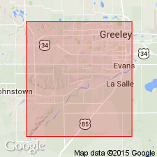
Named as the upper member of the Fox Hills formation. The best exposures are in the bluffs on north side of Thompson below mouth of Little Thompson, at Wildcat Mound, near mouth of the St. Vrain, and on south side of Cache la Poudre, southeast of Windsor, Larimer Co, CO in the Denver basin. Named for excellent exposures near Milliken station west of LaSalle in Weld Co. Type locality not designated. Consists of 100 to 150 ft of massive, soft, green-yellow sandstone that has one-inch bands in the lower part. Has many large brown concretions and bands that are ferruginous, calcareous and fossiliferous. Is a distinctive unit. [Contacts not clearly stated.] Overlies black and dark-gray shales of [Fox Hills?]. Underlies shales and sandstone of Laramie formation. Cretaceous age.
Source: GNU records (USGS DDS-6; Denver GNULEX).
- Usage in publication:
-
- Milliken sandstone member*
- Modifications:
-
- Areal extent
- AAPG geologic province:
-
- Denver basin
Summary:
Milliken sandstone member is the most persistent sandstone member of the Fox Hills sandstone. Is mapped (geologic map) as a narrow band of exposures just west of Frederick north to T11N, R68W in Larimer Co, CO in the Denver basin. Overlies lower unnamed part of Fox Hills. Underlies Laramie formation. Two measured sections. Is a 63 ft thick yellow medium-grained massive sandstone along Cache la Poudre River. Is a 39 ft thick massive yellow sandstone with three concretion zones at top at Wildcat Mound south of Milliken. Fossil collection (listed) from type locality which is stated to be on north bank of Thompson Creek near center of sec 6, T4N, R66W, Weld Co, CO. Where fossils not present, contact with underlying lower part of Fox Hills and with overlying lower part of Laramie difficult to place because thinner sandstones occur above and below the Milliken.
Source: GNU records (USGS DDS-6; Denver GNULEX).
For more information, please contact Nancy Stamm, Geologic Names Committee Secretary.
Asterisk (*) indicates published by U.S. Geological Survey authors.
"No current usage" (†) implies that a name has been abandoned or has fallen into disuse. Former usage and, if known, replacement name given in parentheses ( ).
Slash (/) indicates name conflicts with nomenclatural guidelines (CSN, 1933; ACSN, 1961, 1970; NACSN, 1983, 2005, 2021). May be explained within brackets ([ ]).