The National Geologic Map Database is migrating to a new infrastructure. We apologize for any service disruptions during this process.
|
|---|


- Usage in publication:
-
- Milligen formation*
- Modifications:
-
- Named
- Dominant lithology:
-
- Argillite
- AAPG geologic province:
-
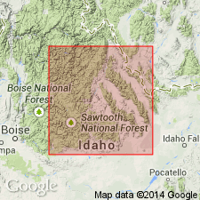
- Snake River basin
Summary:
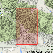
Lower part of sequence designated Wood River formation by Lindgren (1900) removed from Wood River and named Milligen formation for largest exposure 6 miles east of Ketchum on Milligen Creek, Blaine Co, ID in the Snake River basin. No type locality designated. Crops out in irregular northwest-trending belts and in a few areas outside these belts. Weathers easily. Does not make continuous exposures. Thought to be about 3,000 ft thick. Consists mostly of black calcareous argillite. Some beds are calcareous. Some beds are quartzitic. Some are distinctly laminated. Many of the cleavage faces are coated with graphite. Quartzite, limestone, and dolomitic limestone beds intercalated with the argillite. The quartzite is fine grained and occurs as beds 1 to 6 inches thick, and forms massive outcrops. The limestone is ledge-forming, blue-black, fine grained, thin bedded and weathers into blue-gray thin rough slabs. The dolomitic limestone is dark blue, in beds 4 or 5 ft thick, and weathers rusty-brown color. Is younger than the newly named Silurian Trail Creek formation. Lies below the Pennsylvanian Wood River formation--contact not clear. Basal Wood River is usually a conglomerate. Separated from all formations other than Wood River by faults. Fossils: corals, stromatoporoids, crinoids. Basal part may be Devonian. Upper part is Mississippian. Geologic maps. Columnar sections.
Source: GNU records (USGS DDS-6; Denver GNULEX).
- Usage in publication:
-
- Milligen formation*
- Modifications:
-
- Areal extent
- Revised
- Overview
- AAPG geologic province:
-
- Idaho Mountains province
- Snake River basin
Summary:
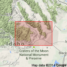
In previous reports, Milligen has been recognized along both sides of the Big Wood River, from Gannett to Hailey, and with interruptions from Pole Creek near head of Salmon River in Sawtooth quad, Camas and Blaine Cos, ID in the Snake River basin, across White Clouds Peaks in Custer quad, Custer Co, ID in the Idaho Mountains province, and extending to the mouth of Slate Creek. In this report, Milligen recognized as present in the southern part of the Lost River Range, Butte Co, Lava Creek district, Butte Co, and probably the Muldoon district, Blaine Co, ID in the Snake River basin. Consists mostly of black carbonaceous argillite and a few intercalated quartzite, limestone, and dolomitic limestone. Weathers easily; has few distinctive units; is much deformed. Estimated at 2,500 to 3,000 ft thick. Unconformably overlain by conglomerate at the base of the Pennsylvanian Wood River formation. Revised in that it overlies Devonian rocks that are unnamed in the Lost River Range or of the newly named Grand View dolomite in the Bayhorse, Custer, and Sawtooth quads. Fossils: plant fragments, brachiopods. Fossils listed. Mississippian age assigned. Correlation chart.
Source: GNU records (USGS DDS-6; Denver GNULEX).
- Usage in publication:
-
- Milligen Formation*
- Modifications:
-
- Contact revised
- AAPG geologic province:
-
- Snake River basin
Summary:
Upper contact revised in that the Milligen Formation of Mississippian age underlies and intertongues with the newly named White Knob Limestone. White Knob replaces use of Brazer Limestone everywhere in south-central ID in the Snake River basin.
Source: GNU records (USGS DDS-6; Denver GNULEX).
- Usage in publication:
-
- Milligen Formation*
- Modifications:
-
- Revised
- AAPG geologic province:
-
- Snake River basin
Summary:
Revised in that it underlies the newly named Middle Canyon Formation of the White Knob Group (raised in stratigraphic rank) in the southern Lemhi Range, Butte Co, ID in the Snake River basin.
Source: GNU records (USGS DDS-6; Denver GNULEX).

- Usage in publication:
-
- Milligen Formation
- Modifications:
-
- Revised
- Reference
- Dominant lithology:
-
- Argillite
- Quartzite
- Conglomerate
- AAPG geologic province:
-
- Idaho Mountains province
Summary:
Assigned as the basal formation (of six formations) to the Copper Basin Group (rank raised). Stratigraphic base of Milligen is unknown. Its upper contact with the Drummond Mine Limestone (new) of Copper Basin is gradational; the contact is placed where limestone predominates over argillite. Most exposures are poor and structurally complex. Reference section designated and measured from SW1/4 NE1/4 SE1/4 sec 22 to center NE1/4 NW1/4 sec 23, T4N, R21E, Blaine Co, ID in the Idaho Mountains province. Is 3,200 ft thick at the reference section where it consists of dark-gray (brown weathering) argillite interbedded with minor amount medium- to dark-gray, moderately well-sorted, silt- to sand-size, angular to subround particles of quartz (75-80 percent), epidote (up to 15 percent), plagioclase and chert (0-3 percent), quartzite and granule-size conglomerate. Argillite weathers to a blocky talus. Conglomerate is poorly sorted and locally has graded bedding. Only fossils found were poorly preserved plants. Assigned to the Lower? and Upper? Mississippian. Correlation chart. Stratigraphic sections.
Source: GNU records (USGS DDS-6; Denver GNULEX).
- Usage in publication:
-
- Milligen Formation*
- Modifications:
-
- Principal reference
- Biostratigraphic dating
- Dominant lithology:
-
- Argillite
- Conglomerate
- AAPG geologic province:
-
- Snake River basin
Summary:
Areally restricted; name should not be used in east-central ID or extreme western MT. Crops out discontinuously in a belt 50 km long and as much as 11 km wide, Blaine Co, ID, Snake River basin, extending from just south of Bellevue to southern Boulder Mountains. Most of thin beds have poorly to moderately well developed cleavage at an angle of about 60 deg to original bedding. Float has a distinctive crinkly appearance and phyllitic sheen that aids in distinguishing Milligen from similar lithologies in other formations. Maximum deposited thickness unknown; base not exposed. Deposited presumably on Silurian Trail Creek Formation. Middle Pennsylvanian Hailey Conglomerate Member deposited unconformably on Milligen. Maximum thickness estimated at 4,000 ft. Principal reference section designated on east side Milligen Gulch, N1/2 NW1/4 sec 19, T4N, R19E, Hyndman Peak quad, Blaine Co, where 1,312 ft measured, and divided into lower member, a gray to black, carbonaceous, siliceous argillite with thin, gray, fine-grained quartzite, and upper member, a granule- and pebble-conglomerate of gray limestone. Geologic map. Has Middle Devonian (Eifelian) conodonts in middle of lower member; early Late Devonian Lower and Middle POLYGNATHUS ASYMMETRICUS Zones in upper member. Fossils listed. Spans Devonian. Deposited in deep water in continental-use environment. Is older and unrelated to Lower Mississippian argillite called Milligen elsewhere in ID.
Source: GNU records (USGS DDS-6; Denver GNULEX).
- Usage in publication:
-
- Milligen Formation
- Modifications:
-
- Not used
Summary:
Name Milligen Formation--as the basal formation of Copper Basin Group--has been applied to thick argillite of Late Devonian? to Mississippian age beneath the Wood River Formation in south-central ID and north of the Snake River plain. Type Milligen is a deep-water deposit of Devonian age. Name McGowan Creek Formation has replaced Milligen for Lower Mississippian rocks in Lost River Range, east-central ID. Rocks in the Pioneer Mountains formerly assigned to Milligen and to basal Copper Basin Group are recognized as of different lithology and age from type Milligen. In the Pioneers, the basal 3,700+ ft thick unit of mostly dark-gray argillite with some interbeds of quartzite, granule-size conglomerate, and a few limestone beds is named Little Copper Formation, basal formation of Copper Basin Group. Former reference section (Paull and others, 1972) of Milligen is redesignated the type section of Little Copper Formation. Term Milligen to be used in Wood River valley area only.
Source: GNU records (USGS DDS-6; Denver GNULEX).
- Usage in publication:
-
- Milligen Formation*
- Modifications:
-
- Overview
- AAPG geologic province:
-
- Snake River basin
Summary:
Mapped in southern and southwestern parts of study area in Blaine Co, ID, Snake River basin. Consists mostly of dark-colored, gray-weathering, slabby, phyllitic to subphyllitic argillite and black, thin-bedded to massive, carbonaceous to siliceous, cherty argillite. Lesser amounts of fine-grained quartzite, siltstone, and rare micritic to granular bioclastic limestone occur in lower part. Combined minimum thickness of 1200 m is tentative because internal stratigraphy and structure are poorly known, largely unmapped, and spotty fossil control makes correlations within unit uncertain. Upper and lower contacts are both tectonic; internal deformation is complex. In part correlates with unnamed Devonian and Silurian rocks; older than Milligen Formation. Conodonts suggest age ranges from at least early Middle Devonian (Eifelian) through early Late Devonian (Frasnian), however, as substantial sections of undated rocks are present above and below dated beds, actual age range may be much greater.
Source: GNU records (USGS DDS-6; Denver GNULEX).
- Usage in publication:
-
- Milligen Formation
- Modifications:
-
- Overview
- AAPG geologic province:
-
- Snake River basin
Summary:
Exposed in north-trending belt 30 mi long by up to 6 mi wide within Blaine Co, ID, Snake River basin (fig. 1). Divided into five informal units, in ascending order: unnamed lower sand unit, Lucky Coin limestone, Triumph argillite, Cait quartzite, and Independence sandstone. Lower sand unit consists of carbonate cemented quartz sand interbedded with dark-gray argillites; thickness is 400 ft. Lucky Coin limestone, named for exposures near prospect in lower Independence Canyon, consists of silty limestone interbedded with carbonaceous, siliceous argillites; thickness is variable though can exceed 1200 ft. Triumph argillite [derivation of name not discussed] is characterized by carbonaceous argillite but includes interbeds of siliceous argillite, bedded chert, limestone, fine-grained sandstone and coarse-grained quartzite; thickness is typically a few hundred feet though locally is 500 ft. Cait quartzite [derivation of name not discussed] consists of coarse-grained quartzite; thickness is variable though locally exceeds 300 ft. Independence sandstone, named for exposures in Independence Canyon where it is over 1000 ft thick, consists of quartz grains in a calcareous to dolomitic cement; top is not exposed due to fault truncation; channel facies and "interbedded" facies occur within unit. Milligen deposited in an outer miogeoclinal environment. Early and Late Devonian age based on conodonts.
Source: GNU records (USGS DDS-6; Denver GNULEX).
- Usage in publication:
-
- Milligen Formation*
- Modifications:
-
- Areal extent
- Overview
- AAPG geologic province:
-
- Snake River basin
Summary:
Tentatively recognized east of Kent Peak and in Miller Canyon area on east slope of Boulder Mountains near head of North Fork of Big Lost River, Blaine Co, ID, Snake River basin. Milligen and Trail Creek of this report in Kent Peak-Miller Canyon area were mapped by Dover (1983, USGS map I-1319) as part of his unnamed Silurian and Devonian rocks. Distinctive marker beds allow correlation of Milligen across structurally complex areas. Upper contact varies along strike: is locally an unconformity below Hailey Member of Wood River Formation; is possibly conformable with rocks mapped as Copper Basin Formation; or is a fault against younger strata. Upper contact is not a regional thrust fault. Base of Milligen has not been observed in Triumph Mine area or on western side of Boulder Mountains; in eastern Boulder Mountains basal contact may be gradational with underlying calcareous siltstone that contains Silurian and Early Devonian conodonts. For the most part correlates with the Salmon River assemblage in the White Cloud Peaks area. Milligen is host for rich silver-lead-zinc ores near Hailey and Bellevue, Blaine Co, ID. Geologic map; stratigraphic columns; conodont zonation and fossil list. Early to Late Devonian age.
Source: GNU records (USGS DDS-6; Denver GNULEX).
For more information, please contact Nancy Stamm, Geologic Names Committee Secretary.
Asterisk (*) indicates published by U.S. Geological Survey authors.
"No current usage" (†) implies that a name has been abandoned or has fallen into disuse. Former usage and, if known, replacement name given in parentheses ( ).
Slash (/) indicates name conflicts with nomenclatural guidelines (CSN, 1933; ACSN, 1961, 1970; NACSN, 1983, 2005, 2021). May be explained within brackets ([ ]).