The National Geologic Map Database is migrating to a new infrastructure. We apologize for any service disruptions during this process.
|
|---|


- Usage in publication:
-
- Millersview limestone member
- Modifications:
-
- Original reference
- Dominant lithology:
-
- Limestone
- AAPG geologic province:
-
- Permian basin
Summary:
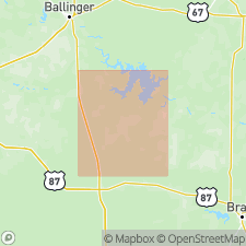
Pg. 1579, 1581. Millersview limestone member of Grape Creek formation. Is 2-foot gray bed lying 780 feet above Coleman Junction limestone. Crops out in W/2 T.F. Benge survey No. 100, 4.5 mi south-southwest of Millerview on road having that bearing from the village, Concho County, central Texas. Has been traced across southeastern part of Runnels County to point 4.5 miles north of southeast corner of that county. As it is persistent ledge maker it is considered top member of Grape Creek formation. [Age is Permian.]
Source: US geologic names lexicon (USGS Bull. 896, p. 1372).
For more information, please contact Nancy Stamm, Geologic Names Committee Secretary.
Asterisk (*) indicates published by U.S. Geological Survey authors.
"No current usage" (†) implies that a name has been abandoned or has fallen into disuse. Former usage and, if known, replacement name given in parentheses ( ).
Slash (/) indicates name conflicts with nomenclatural guidelines (CSN, 1933; ACSN, 1961, 1970; NACSN, 1983, 2005, 2021). May be explained within brackets ([ ]).