

- Usage in publication:
-
- Mille Lacs Group
- Modifications:
-
- Named
- Dominant lithology:
-
- Conglomerate
- Sandstone
- Quartzite
- Argillite
- Metavolcanics
- AAPG geologic province:
-
- Lake Superior region
Summary:
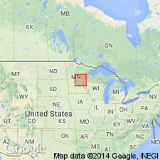
Named for sequence of quartzose sedimentary rocks near Mille Lacs Lake, Mille Lacs and Aitkin Cos, east-central MN in the Lake Superior region. Subdivided into (ascending) Denham (new), Little Falls (new), Glen Township (new), Randall (new), and Trout Lake Formations. Dominantly metamorphosed beds of sandstone, conglomerate, minor siliceous dolomite, and impure limestone. Also contains interlayered volcanogenic and hypabyssal rocks of mafic to intermediate composition. Geologic map. Unconformably underlies Animikie Group and overlies Algoman or early Precambrian-age rocks. Is assigned a middle Precambrian age.
Source: GNU records (USGS DDS-6; Denver GNULEX).
For more information, please contact Nancy Stamm, Geologic Names Committee Secretary.
Asterisk (*) indicates published by U.S. Geological Survey authors.
"No current usage" (†) implies that a name has been abandoned or has fallen into disuse. Former usage and, if known, replacement name given in parentheses ( ).
Slash (/) indicates name conflicts with nomenclatural guidelines (CSN, 1933; ACSN, 1961, 1970; NACSN, 1983, 2005, 2021). May be explained within brackets ([ ]).