

- Usage in publication:
-
- Millbrook till*
- Modifications:
-
- Named
- Dominant lithology:
-
- Till
- AAPG geologic province:
-
- Appalachian basin
Summary:
Millbrook till (new name) is sandy, pebbly, and olive-brown. Thickness 4.5 ft. Overlies Paleozoic bedrock. Upper part leached and severely weathered in many localities. Underlies Hayesville till (new) in some areas. Older than Navarre till. A deposit of Killbuck glacial lobe. Age is Illinoian(?) or Wisconsinan(?).
Source: GNU records (USGS DDS-6; Reston GNULEX).
- Usage in publication:
-
- Millbrook Till
- Modifications:
-
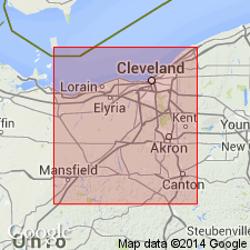
- Areal extent
- Overview
- AAPG geologic province:
-
- Appalachian basin
Summary:
The Millbrook has been traced from Wayne Co. into Holmes, Ashland, and Stark Cos, but does not extend beyond later Wisconsin tills. Correlation of Millbrook Till and determination of its age must await a regional study. It may prove to be an Illinoian deposit of an Illinoian Killbuck lobe, similar to the Illinoian drift of the Grand River lobe. Or it may be a very old Wisconsinan drift, such as the very early Wisconsin drift and associated buried soil reported in western OH and the very old Wisconsin drifts identified in IL and Ontario.
Source: GNU records (USGS DDS-6; Reston GNULEX).
- Usage in publication:
-
- Millbrook Till
- Modifications:
-
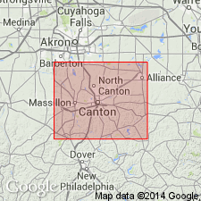
- Areal extent
- Overview
- AAPG geologic province:
-
- Appalachian basin
Summary:
Millbrook Till has been traced from Wayne Co. into Stark, Holmes, Ashland, and Richland Cos. At surface only in southern Richland Co. Medium thickness of 12.6 ft. Described as weakly calcareous, sandy, and pebbly with many cobbles and boulders. Till is olive-gray and weathers olive brown. Correlates with Mogadore, Titusville, and Jelloway Tills. Underlies Navarre and Hayesville Till; overlies Butler Till or bedrock. Age is early Wisconsinan (Altonian).
Source: GNU records (USGS DDS-6; Reston GNULEX).
- Usage in publication:
-
- Millbrook Till
- Modifications:
-
- Age modified
- AAPG geologic province:
-
- Appalachian basin
Summary:
Previous interpretations for a middle or early Wisconsinan age of the Millbrook Till of north-central OH have become suspect with new thermoluminescence ages of 146+/-25 ka and 124+/-16 ka on overlying loess at Mt. Gilead, OH. Much of what has been called Millbrook has been traced to areas previously mapped as Illinoian. There is no longer any support for early to middle Wisconsinan glaciation in northern OH and adjacent PA. Several tills are exposed in a series of stream cuts on the north side of Whetstone Creek on the north side of the fairgrounds, southwestern edge of Mt. Gilead. The four lower tills have field characteristics similar to those of the Millbrook and are jointly referred to informally as Millbrook till B. Therefore, the Millbrook Till originally defined by White (1961) actually consists of several subunits, each having a different source area. These Millbrook subunits may be Illinoian as originally proposed. Two additional tills, which have characteristics of the Millbrook but overlie the subunits of Millbrook till B at Mt. Gilead, are designated informally as Millbrook till U and Millbrook till A. They underlie late Wisconsinan Navarre Till. Millbrook tills U and A may be Illinoian as no weathering profiles have been found in the Millbrook B tills where Millbrook tills U and A overlie them. Author correlates the Mogadore and Titusville tills to the Millbrook BI subunit. Millbrook till A probably correlates with the Northampton Till. The Keefus Till may correlate with Millbrook till BIII, but no other correlatable tills have been found.
Source: GNU records (USGS DDS-6; Reston GNULEX).
For more information, please contact Nancy Stamm, Geologic Names Committee Secretary.
Asterisk (*) indicates published by U.S. Geological Survey authors.
"No current usage" (†) implies that a name has been abandoned or has fallen into disuse. Former usage and, if known, replacement name given in parentheses ( ).
Slash (/) indicates name conflicts with nomenclatural guidelines (CSN, 1933; ACSN, 1961, 1970; NACSN, 1983, 2005, 2021). May be explained within brackets ([ ]).