The National Geologic Map Database is migrating to a new infrastructure. We apologize for any service disruptions during this process.
|
|---|


- Usage in publication:
-
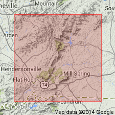
- Mill Spring complex
- Modifications:
-
- First used
- Dominant lithology:
-
- Gneiss
- Metagraywacke
- Amphibolite
- AAPG geologic province:
-
- Piedmont-Blue Ridge province
Summary:
Davis (1993: Univ. of TN, Ph.D. dissertation) redefined the lithostratigraphy of the Columbus Promontory to include four major units including the Henderson Gneiss, the Sugarloaf gneiss, the Poor Mountain Formation, and the Mill Spring complex. New framework is consistent in many ways with original ideas of Lemmon (1973: Univ. of NC, Ph.D. dissertation). These units comprise three thrust sheets. The Sugarloaf Mountain thrust sheet includes the Sugarloaf gneiss, the Poor Mountain Formation, and the upper Mill Spring complex. The Mill Spring thrust sheet contains the lower Mill Spring complex. The upper Mill Spring is the stratigraphically lowest unit of the Sugarloaf Mountain thrust sheet. It consists predominantly of a thick sequence of migmatitic biotite gneiss and metagraywacke, and is distinguished from the lower Mill Spring by the lower relative abundance of mafic rocks. Forms cliffs and balds throughout the study area. The lower Mill Spring consists of a migmatitic sequence of biotite-granitic gneiss-metagraywacke, coarse amphibolite gneiss, and fine- to medium-grained amphibolite. [Rb-Sr isochron age of the Mill Spring complex is 308+/-2 Ma according to Goldberg and Fullagar (p. 105-107, this volume), but authors state more study is needed to confirm preliminary Alleghanian metamorphic age.]
Source: GNU records (USGS DDS-6; Reston GNULEX).
For more information, please contact Nancy Stamm, Geologic Names Committee Secretary.
Asterisk (*) indicates published by U.S. Geological Survey authors.
"No current usage" (†) implies that a name has been abandoned or has fallen into disuse. Former usage and, if known, replacement name given in parentheses ( ).
Slash (/) indicates name conflicts with nomenclatural guidelines (CSN, 1933; ACSN, 1961, 1970; NACSN, 1983, 2005, 2021). May be explained within brackets ([ ]).