

- Usage in publication:
-
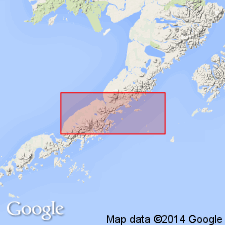
- Milky River Formation*
- Modifications:
-
- Adopted
- Dominant lithology:
-
- Volcanics
- Sandstone
- Conglomerate
- Tuff
- AAPG geologic province:
-
- Alaska Peninsula province
Summary:
Named for Milky River in central Alaska Peninsula. Milky River Formation, named but not defined by Galloway (1974, GSA Bull. v.85 no.3, p.381,384) is adopted. Type locality designated on northeast spur of unnamed mountain (secs.14, 15,22 T48S R69W), 12 km east of Bear Lake, central Alaska Peninsula. Consists of volcanogenic nonmarine sedimentary rocks with interlayered flows and sills. Lower part (1000 m thick) is nearly all volcanic sandstone and cobble-boulder conglomerate. Upper part is porphyritic andesite flows, lahars, and tuff beds. Is 1525 m thick at type. Unconformably overlies Bear Lake Formation; unconformably underlies volcanic flows and surficial deposits. Age given as Pliocene in part based on radiometric age of 3 MA of flow in upper part.
Source: GNU records (USGS DDS-6; Menlo GNULEX).
For more information, please contact Nancy Stamm, Geologic Names Committee Secretary.
Asterisk (*) indicates published by U.S. Geological Survey authors.
"No current usage" (†) implies that a name has been abandoned or has fallen into disuse. Former usage and, if known, replacement name given in parentheses ( ).
Slash (/) indicates name conflicts with nomenclatural guidelines (CSN, 1933; ACSN, 1961, 1970; NACSN, 1983, 2005, 2021). May be explained within brackets ([ ]).