- Usage in publication:
-
- Mifflintown limestone
- Modifications:
-
- Named
- Dominant lithology:
-
- Limestone
- AAPG geologic province:
-
- Appalachian basin
Summary:
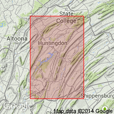
A "peculiar" unit that occurs near bottom of upper red shale member of Clinton formation is described as 6 ft of hard calcareous sandstone layers, each 2, 3, or 4 in. thick, separated by very thin layers of calcareous sandstone, mottled with red. This group is recognizable at distant localities and sometimes becomes a limestone, as near Mifflintown in Juniata Co., on west bank of Juniata River, where some beds of very hard comparatively pure limestone, 3 or 4 ft thick crop out. Age is of this Mifflintown limestone is Silurian.
Source: GNU records (USGS DDS-6; Reston GNULEX).

- Usage in publication:
-
- Mifflintown Formation
- Modifications:
-
- Revised
- AAPG geologic province:
-
- Appalachian basin
Summary:
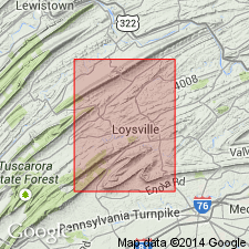
Mifflintown revised to Formation and redefined to include the Keefer, Rochester, and McKenzie Members (all reduced in rank). A composite type section is designated consisting of two exposures near Mifflintown, PA, in Mifflintown quad. Keefer and Rochester Members well exposed along main line of Pennsylvania RR, 0.25 mi northwest of Borough boundary of Mifflintown. Exposure is 2,900 ft south of lat 40 deg 35' N., and 2,800 ft east of long 77 deg 25' W. With exception of upper 40 ft of McKenzie Member, complete formation is exposed in roadcut on east side of U.S. Rte 22, 0.3 mi north of Borough boundary of Mifflintown. Highway exposure is 2,000 ft south of lat 40 deg 35' N., and 4,900 ft east of long 77 deg 25' W. Thickness at type section is 299 ft. Age is Early Silurian. (Originally term Mifflin was suggested (Arndt and others, 1959) for this unit, but because of preoccupation it was decided to redefine and clarify Lesley's term.)
Source: GNU records (USGS DDS-6; Reston GNULEX).

- Usage in publication:
-
- Mifflintown Formation
- Modifications:
-
- Overview
- AAPG geologic province:
-
- Appalachian basin
Summary:
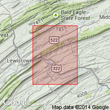
Mifflintown Formation described in this report. Available evidence indicates that Mifflintown limestone of Lesley (1878) is equivalent to some parts of Mifflintown of this report. Thickness 200 to 300 ft. Overlies Rose Hill Formation; underlies Bloomsburg Formation. Age is Silurian.
Source: GNU records (USGS DDS-6; Reston GNULEX).

- Usage in publication:
-
- Mifflintown Formation
- Modifications:
-
- Overview
- AAPG geologic province:
-
- Appalachian basin
Summary:
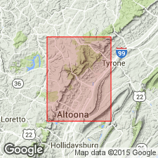
The lowest part of the Mifflintown, the Rochester Member, is mostly a very fissile, medium-gray shale containing subordinate interbeds of very thin to thin-bedded, medium-light-gray fossiliferous limestone. Percentage of limestone increases upsection. The middle sequence, called the McKenzie Member, consists of interbedded limestone and shale and the limestone consists of medium-gray to medium-dark-gray, very thin to thin-bedded, homogeneous calcisiltite, partly magnesian and having ripple marks. Also contains a few beds of medium-gray, very thin bedded, pelletal, fine-grained calcarenite. Sequence becomes more shaly upsection. Approximately 30 m below the top of the Mifflintown, is a series of red beds termed the Rabble Run Member. The red shale is grayish red, calcareous, fossiliferous, and medium to thick bedded. The gray shale within the Member is medium gray, weathering to pale yellowish brown, noncalcareous, and very thin bedded. The Rabble Run Member is 40 m thick in an exposure along U.S. Rte 22 north of Point View in the Williamsburg quad. Above the Rabble Run is a sequence containing interbedded fossiliferous limestone and a subordinate amount of fossiliferous shale. The limestone is medium gray and very thin to thin bedded and contains brachiopods, gastropods, crinoids, and trilobites. Cross-bedding, graded beds, and ripple marks are evident. Mifflintown conformably overlies the Keefer Formation and underlies the Bloomsburg Formation. Thickness is 190+/-20 m as calculated from dip and map-pattern widths. Age is Early and Late Silurian. [State Survey does not use Middle Silurian.]
Source: GNU records (USGS DDS-6; Reston GNULEX).
For more information, please contact Nancy Stamm, Geologic Names Committee Secretary.
Asterisk (*) indicates published by U.S. Geological Survey authors.
"No current usage" (†) implies that a name has been abandoned or has fallen into disuse. Former usage and, if known, replacement name given in parentheses ( ).
Slash (/) indicates name conflicts with nomenclatural guidelines (CSN, 1933; ACSN, 1961, 1970; NACSN, 1983, 2005, 2021). May be explained within brackets ([ ]).

