The National Geologic Map Database is migrating to a new infrastructure. We apologize for any service disruptions during this process.
|
|---|


- Usage in publication:
-
- Middlebrook group
- Modifications:
-
- Areal extent
- Dominant lithology:
-
- Felsite
- AAPG geologic province:
-
- Midcontinent region
Summary:
Middlebrook group (new). Briefly summarized in reports by W.C. Hayes and J.A. Martin, p. 51 (incidental mention in road log), and W.C. Hayes, p. 81, 82, 83 (table 1), this volume. New names are credited to Tolman and Robertson (in prep.) [1969, Missouri Div. Geol. Survey Water Res. Rpt. Inv., no. 44 (Contrib. to Precambrian Geol., no. 1)]. Felsites of St. Francois Mountain divided into two groups, Middlebrook, older, and Van East, younger. Middlebrook composed mainly of rhyolite flows which have high potash-soda ratio in which potash content ranges to maximum of 9.76 percent. Tuff present above many flows assigned to group, and it separates them from flows of Van East group. Includes Clark Mountain rhyolite, Marlow Mountain rhyolite, Oak Mountain felsite, Royal Gorge rhyolite, and Pilot Knob felsite (all new) and some miscellaneous units. Age is Precambrian.
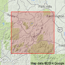
Middlebrook Village is in Iron Co., southeastern MO. Middlebrook Hill consists of unassigned felsites of Middlebrook group.
Source: Modified from US geologic names lexicon (USGS Bull. 1350, p. 486).
- Usage in publication:
-
- Middlebrook group
- Modifications:
-
- Principal reference
- Dominant lithology:
-
- Rhyolite
- AAPG geologic province:
-
- Midcontinent region
Summary:
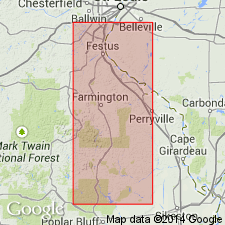
Middlebrook group. Present in St. Francois Mountains, southeastern Missouri. Notable exposures near town of Middlebrook and Pilot Knob, Iron County; near Iron Mountain, St. Francois County; and south of Silver Mine, Madison County. Includes 6 named units (in alphabetical order) Clark Mountain rhyolite, Marlow Mountain rhyolite, Oak Mountain rhyolite, Pilot Knob felsite, Royal Gorge rhyolite, and Stegall rhyolite, and several unnamed units that have a small areal extent and/or don't have established stratigraphic relationships to other units. Is oldest of pre-batholithic rocks, older than Van East group. Upper boundary is an erosional unconformity; erosion may have removed more than 1,000 feet of Middlebrook. Lies below Ketcherside tuff which separates the petrographically similar Middlebrook and Van East groups. Similarities between the two groups suggest a genetic relationship and their emplacement represents a relatively short interval of time. Age is Precambrian.
Named from exposures near town of Middlebrook, Iron Co., southeastern MO. (Type locality not designated.)
[GNU remark (Feb. 21, 1990, USGS DDS-6; Denver GNULEX): Stratigraphic relationships of units of Middlebrook not discussed in text; geologic map (plate 1) missing from library copy of report.]
Source: Modified from GNU records (USGS DDS-6; Denver GNULEX).
- Usage in publication:
-
- Middlebrook Group
- Modifications:
-
- Not used
Summary:
Middlebrook Group. Not used in western St. Francois Mountains, southeast Missouri (Midcontinent region). Nomenclature of Tolman and Robertson (1969) revised because of better understanding of regional structure and recognition of individual units consisting of ash-flow tuffs, air-fall tuffs, lava flows, and mixtures of these. Replaced with newly named formations (alphabetical): Bell Mountain Rhyolite (College Hill); Buck Mountain Shut-ins Formation (Russell Mountain); Cedar Bluff Rhyolite (near Cedar Bluff School); Cope Hollow Formation (north of swimming area of Johnson Shut-ins State Park); Lindsey Mountain Rhyolite (Bell and North Bell Mountains); Pond Ridge Rhyolite (Russell Mountain); Royal Gorge Rhyolite (College Hill); and Wildcat Mountain Rhyolite (College Hill).
[GNC remark (February 29, 2008): It appears that †Middlebrook group has not been applied to these rocks since its introduction. Considered abandoned.]
Source: Modified from GNU records (USGS DDS-6; Denver GNULEX).
For more information, please contact Nancy Stamm, Geologic Names Committee Secretary.
Asterisk (*) indicates published by U.S. Geological Survey authors.
"No current usage" (†) implies that a name has been abandoned or has fallen into disuse. Former usage and, if known, replacement name given in parentheses ( ).
Slash (/) indicates name conflicts with nomenclatural guidelines (CSN, 1933; ACSN, 1961, 1970; NACSN, 1983, 2005, 2021). May be explained within brackets ([ ]).