The National Geologic Map Database is migrating to a new infrastructure. We apologize for any service disruptions during this process.
|
|---|


- Usage in publication:
-
- Middle Park beds
- Modifications:
-
- Original reference
- Dominant lithology:
-
- Breccia
- Conglomerate
- AAPG geologic province:
-
- North Park basin
Summary:
Pg. 137. Middle Park beds in many particulars similar to Denver formation. Upper part consists of sandy shales, sandstones, and grits chiefly of granitic origin; contains lignitic material and many fossil leaves. Lower part consists of 800 to 900 feet of andesitic breccias and conglomerates with interstratified sands bearing fossil plants; contains seams of lignitic material and many fossil leaves. Rests unconformably on Cretaceous. Age is Eocene.
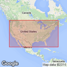
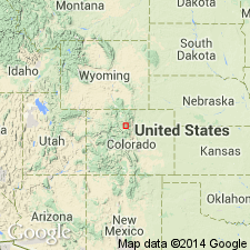
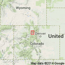
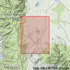
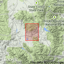
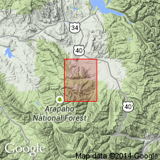
Occurs in Middle Park, [Grand Co.], CO.
Source: US geologic names lexicon (USGS Bull. 896, p. 1363).
- Usage in publication:
-
- Middle Park Formation*
- Modifications:
-
- Revised
- AAPG geologic province:
-
- North Park basin
Summary:
Basal volcanic breccia, volcanic sandstone and conglomerate with andesite fragments that ranges from 0-1,150 ft thick named Windy Gap Volcanic Member of Middle Park Formation from exposures at Windy Gap, Grand Co, CO in the North Park basin. Windy Gap overlies the gray Pierre Shale and underlies an unnamed part of the Middle Park. Upper contact gradational. Windy Gap grades into grits with large amount of Precambrian granite pebbles. Contact usually placed arbitrarily at lowest occurrence of Precambrian granitic rock and microcline fragments. [Overlying parts of Middle Park not discussed.] Windy Gap is Late Cretaceous age. Middle Park is Late Cretaceous and Paleocene.
Source: GNU records (USGS DDS-6; Denver GNULEX).
- Usage in publication:
-
- Middle Park Formation*
- Modifications:
-
- Areal extent
- AAPG geologic province:
-
- North Park basin
Summary:
Middle Park Formation. In the Hot Sulphur Springs quadrangle, Grand County, northwestern Colorado, unconformably underlies Pete Gulch Member of Rabbit Ears Volcanics (new; Oligocene); at Grouse Mountain, unconformably underlies Grouse Mountain Basalt (new; Pliocene?). Age is Late Cretaceous and early Tertiary.
Source: Publication.
- Usage in publication:
-
- Middle Park Member*
- Modifications:
-
- Revised
- AAPG geologic province:
-
- North Park basin
Summary:
Reduced in stratigraphic rank in map area from Middle Park Formation to Middle Park Member, basal member of Coalmont Formation. Ranges between 0 and 600 ft thick. Distinguished on basis of its volcanic pebble beds. Consists of arkosic sandstone and conglomerate, sandy claystone, mudstone, and sparse thin carbonaceous shale. The coarser arkosic beds contain angular fragments of quartz, feldspar. The volcanic fragments are mostly medium- to light-gray-weathering porphyritic andesite of pebble (2 in) to sand size. Conglomerate beds are resistant and form steep scarps. Overlies sandstone member of Pierre Shale unconformably. Underlies middle member of Coalmont. Upper contact placed at highest occurrence of gravelly beds with water-worn pebbles of porphyritic andesite. Otherwise the lithologies of the Middle Park and the middle member are similar. Mapped (geologic map) in Grand Co around west and south sides of Ryder Lakes. Is probably a channel deposit derived from a southeast source. Assigned a Paleocene age.
Source: GNU records (USGS DDS-6; Denver GNULEX).
- Usage in publication:
-
- Middle Park Formation*
- Modifications:
-
- Age modified
- AAPG geologic province:
-
- North Park basin
Summary:
Is a coarse intermontane fill deposit (mostly lenticular arkosic sandstone and grit) that resulted from erosion of Front and Park Ranges. Laid down in southern part of a large north-trending structural depression known as the North-Middle Park basin [North Park basin]. Rests discordantly on rocks of Pierre or older Mesozoic or Precambrian age. Is older than Rabbit Ears Volcanics. Windy Gap Volcanic Member present locally at base. Upper part divisible into four map units (geologic map). Section 6,600 ft thick measured along Colorado State Hwy 125 northwest from Gold Run that includes Windy Gap (650 ft thick greenish-gray volcanic breccia) and an upper part (5,900 ft thick, very fine, fine- to coarse-grained, arkosic, micaceous sandstone that varies from thin to thick bedded, and olive-gray and dusky yellow, stuctureless, thin-bedded clayey siltstone at base). Late Cretaceous? and Paleocene age (formerly Cretaceous not questioned) assigned on basis of stratigraphic position above Pierre, its fossil leaves, pollen, and spores (listed), and its correlation with Denver Formation.
Source: GNU records (USGS DDS-6; Denver GNULEX).
- Usage in publication:
-
- Middle Park Formation*
- Modifications:
-
- Overview
- AAPG geologic province:
-
- North Park basin
Summary:
Is Paleocene and Upper Cretaceous(?) formation mapped mostly in northwest part of quadrangle in Grand Co., CO (North Park basin). Unconformably overlies Pierre Shale (Upper Cretaceous) and older bedrock units. Unconformably overlain by Troublesome Formation (Miocene) and Quaternary deposits. Map unit described as interbedded siltstone, mudstone, sandstone, and conglomerate; dominantly arkosic and micaceous; beds are variegated shades of gray, brown, maroon, and rusty orange; coarse clastics are chiefly derived from Precambrian rocks, primarily granodiorite, quartz monzonite, pegmatite, aplite, and other intrusive rocks, and feldspathic gneiss; in lower 500 ft amount of porphyritic andesite, trachyandesite, and other porphyries increases, locally forming as much as half of the rock. Potentially unstable even on gentle slopes; many landslides. Maximum thickness more than 2,000 ft. Windy Gap Volcanic Member (Upper Cretaceous?) separately mapped at base.
Source: GNU records (USGS DDS-6; Denver GNULEX).
For more information, please contact Nancy Stamm, Geologic Names Committee Secretary.
Asterisk (*) indicates published by U.S. Geological Survey authors.
"No current usage" (†) implies that a name has been abandoned or has fallen into disuse. Former usage and, if known, replacement name given in parentheses ( ).
Slash (/) indicates name conflicts with nomenclatural guidelines (CSN, 1933; ACSN, 1961, 1970; NACSN, 1983, 2005, 2021). May be explained within brackets ([ ]).