

- Usage in publication:
-
- Middle Granville Slate
- Modifications:
-
- Original reference
- Dominant lithology:
-
- Slate
- AAPG geologic province:
-
- New England province
Summary:
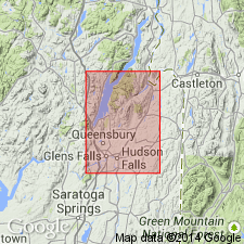
Credited to W.S.F. Kidd, L.L. Delano, and D.B. Rowley. Geol. map, p. 25-26 (pamphlet). Middle Granville Slate. Extensively quarried green, purple, maroon, and gray slates in Washington County, New York, previously mapped as the Mettawee Slate and as part of the West Castleton Formation, are here named the Middle Granville Slate. Contains local interbeds of micrite, in places reduced to layers of nodules; weathers to a distinctive tan color. Overlies the Browns Pond Formation; the contact is placed where gray slate changes upward to green slate. Underlies the Hatch Hill Formation; the contact is placed where slates change upward to sooty, fissile black slates. Thickness at the type section is 95 m. Age is Early Cambrian, based on fossils (ELLIPTOCEPHALA ASAPHOIDES fauna), citing Dale (1899) and Theokritoff (1984).
Type section: [along NY State Hwy 22A,] in quarries and adjacent outcrops 300 to 1,500 m north-northwest of the bridge over the Mettawee River at Middle Granville, [Granville 7.5-min quadrangle, Washington Co., eastern NY].
Reference sections:
(1) non-working quarry 2 mi N. 24 deg. E. of bridge over Mettawee River at Truthville, west side of Holcombville Road, [approx. Lat. 43 deg. 28 min. 48 sec. N., Long. 73 deg. 18 min. 29 sec. W., Granville 7.5-min quadrangle, Washington Co., eastern NY], [= stop 2] of Rowley and others (1979);
(2) on northern side of hill [620 ft elev.] in field btw. Holcombville Road and nearby southeastern shore of Browns Pond (3.15 mi N. 13 deg. E. of bridge over Mettawee River at Truthville), [approx. Lat. 43 deg. 29 min. 48 sec. N., Long. 73 deg. 18 min. 39 sec. W., Granville 7.5-min quadrangle, Washington Co., eastern NY];
(3) where 800-ft contour crosses Hills Pond Road, about 0.3 mi north of Hills Pond, [approx. Lat. 43 deg. 31 min. 13 sec. N., Long. 73 deg. 16 min. 52 sec. W., Thorn Hill 7.5-min quadrangle, Washington Co., eastern NY]; and
(4) [2+/- mi west of Granville], outcrop belt in fields along west side of Lee Road, [approx. Lat. 43 deg. 24 min. 12 min. N., Long. 73 deg. 17 min. 40 sec. W., Granville 7.5-min quadrangle, Washington Co., eastern NY].
Source: Publication; US geologic names lexicon (USGS Bull. 1565, p. 199-200).

- Usage in publication:
-
- Middle Granville Formation
- Modifications:
-
- Areal extent
- Revised
- AAPG geologic province:
-
- New England province
Summary:
Used as [informal] Middle Granville Formation of Fisher (1984) [revision of rank term implied] of Cambrian age. Occurs in Taconic allochthon sequence of Glens Falls quad. Overlies Cambrian Browns Pond Formation; underlies Cambrian Bull Formation.
Source: GNU records (USGS DDS-6; Reston GNULEX).
For more information, please contact Nancy Stamm, Geologic Names Committee Secretary.
Asterisk (*) indicates published by U.S. Geological Survey authors.
"No current usage" (†) implies that a name has been abandoned or has fallen into disuse. Former usage and, if known, replacement name given in parentheses ( ).
Slash (/) indicates name conflicts with nomenclatural guidelines (CSN, 1933; ACSN, 1961, 1970; NACSN, 1983, 2005, 2021). May be explained within brackets ([ ]).