

- Usage in publication:
-
- Middle Creek limestone ledge
- Modifications:
-
- Named
- Dominant lithology:
-
- Limestone
- AAPG geologic province:
-
- Williston basin
Summary:
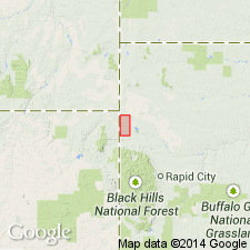
Named as an unranked unit in the upper part of the Graneros formation (Cretaceous). "Approximately 200 feet below the Greenhorn limestone which overlies the Upper Graneros is a thin but persistent limestone ledge. This limestone ledge, herein called the Middle Creek, caps and causes the escarpment trending northwest from Belle Fourche along the northeast side of Middle Creek Valley. It causes also a dip slope toward the north and east into Crow Creek valley. It is a semicrystalline limestone with a somewhat sandy texture on the weathered surface. It contains many black grains and flakes of organic material, and emits a strong petroleum odor when broken. It contains many shark teeth, fossil shells of Inoceramus, and a large, ribbed ammonite, probably Prionocyclus." Although named from exposures along the northwest-trending escarpment on the northeast side of Middle Creek valley, T9N, Rs1-2E, Butte Co, SD (Williston basin), no thickness or type section is given. Is underlain and overlain by unnamed shale beds in the upper part of the Graneros. Northeast of Belle Fourche, a 2 to 4-ft-thick bentonite bed is noted to occur 8 or 9 ft below the crest of the escarpment.
Source: GNU records (USGS DDS-6; Denver GNULEX).
- Usage in publication:
-
- Middle Creek limestone†
- Modifications:
-
- Abandoned
Summary:
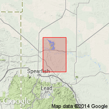
Name abandoned northeast part of Black Hills uplift, Butte and Lawrence Cos, SD in the Williston basin, because of prior usage. Substituted Orman Lake limestone (new).
Source: GNU records (USGS DDS-6; Denver GNULEX).
For more information, please contact Nancy Stamm, Geologic Names Committee Secretary.
Asterisk (*) indicates published by U.S. Geological Survey authors.
"No current usage" (†) implies that a name has been abandoned or has fallen into disuse. Former usage and, if known, replacement name given in parentheses ( ).
Slash (/) indicates name conflicts with nomenclatural guidelines (CSN, 1933; ACSN, 1961, 1970; NACSN, 1983, 2005, 2021). May be explained within brackets ([ ]).