The National Geologic Map Database is migrating to a new infrastructure. We apologize for any service disruptions during this process.
|
|---|


- Usage in publication:
-
- Michigan Formation
- Modifications:
-
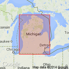
- Areal extent
- AAPG geologic province:
-
- Michigan basin
Summary:
Unit, which is mostly shale, is Osagean and Meramecian in age and conformably overlies the Marshall Sandstone. Underlies the Meramecian Bayport Limestone. Michigan Formation reaches its maximum thickness of 152 m in Missaukee Co. to the north of the central basin area. Thicknesses of 91 to 122 m are more typical. Although generally composed of greenish gray and dark gray shale, this formation is lithologically variable and includes discontinuous beds of sandstone, limestone, dolostone, gypsum, and anhydrite. One of these carbonate beds, called the "Brown Lime," is a 3- to 6-m thick dolostone that can be traced in the subsurface across much of the basin. [No mention of Grand Rapids Group in this report.]
Source: GNU records (USGS DDS-6; Reston GNULEX).
For more information, please contact Nancy Stamm, Geologic Names Committee Secretary.
Asterisk (*) indicates published by U.S. Geological Survey authors.
"No current usage" (†) implies that a name has been abandoned or has fallen into disuse. Former usage and, if known, replacement name given in parentheses ( ).
Slash (/) indicates name conflicts with nomenclatural guidelines (CSN, 1933; ACSN, 1961, 1970; NACSN, 1983, 2005, 2021). May be explained within brackets ([ ]).