- Usage in publication:
-
- Meyer Ridge unit
- Modifications:
-
- [Informally named]
- Dominant lithology:
-
- Basalt
- AAPG geologic province:
-
- Eastern Columbia basin
Summary:
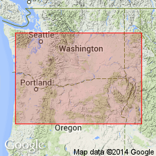
Pg. 23 (fig. 1), 39 (table 2), 47-48. Meyer Ridge unit (informal) in Grande Ronde Basalt of Columbia River Basalt Group. Consists of 2+ flows; fine-grained, plagioclase- and olivine-phyric. Has reversed magnetic polarity (is youngest of R2 magnetostratigraphic units). [Confined to central western part of Columbia Plateau.] Lies above Grouse Creek unit (informal) and below Armstrong Canyon unit (informal); both in Grande Ronde Basalt. Age is early Miocene.
Name and type locality credited to V.E. Camp (1976, Washington State Univ. PhD thesis).
[Type locality: northern end of Meyer Ridge, south of confluence of George and Pintler Creeks, about 3 mi southwest of Asotin, in SW/4 sec. 36, T. 10 N., R. 45 E., western edge of Asotin 7.5-min quadrangle, Asotin Co., eastern WA (see V.E. Camp, 1976, Washington State Univ. PhD thesis, p. 52-53, fig. 12).]
Reference locality: along Patrick Grade, southeast of Dayton in the Blue Mountains, in T. 9 N., R. 40 and 41 E., at border of Eckler Mtn., Panjab Creek, and Cahill Mtn. 7.5-min quadrangles, [Columbia Co.], eastern WA.
[Additional locality information from USGS historical topographic map collection TopoView; accessed September 16, 2013.]
Source: Publication.
For more information, please contact Nancy Stamm, Geologic Names Committee Secretary.
Asterisk (*) indicates published by U.S. Geological Survey authors.
"No current usage" (†) implies that a name has been abandoned or has fallen into disuse. Former usage and, if known, replacement name given in parentheses ( ).
Slash (/) indicates name conflicts with nomenclatural guidelines (CSN, 1933; ACSN, 1961, 1970; NACSN, 1983, 2005, 2021). May be explained within brackets ([ ]).

