The National Geologic Map Database is migrating to a new infrastructure. We apologize for any service disruptions during this process.
|
|---|


- Usage in publication:
-
- Mexican Spring Formation*
- Modifications:
-
- Original reference
- Biostratigraphic dating
- Dominant lithology:
-
- Siltstone
- Sandstone
- AAPG geologic province:
-
- Great Basin province
Summary:
Pg. J5 (fig. 3), J7-J8 (fig. 4), J13-J15, J37, J38. Mexican Spring Formation of Perdido Group. Rocks previously assigned to Perdido Formation (McAllister, 1952). Consists of brown-weathering, massive, highly bioturbated, calcareous, quartzose siltstone and very fine-grained sandstone. Thickness 37 to 97 m. Is top formation of Perdido Group. Underlies Rest Spring Shale; contact placed at top of highest siltstone, sandstone, or limestone turbidite bed below a regionally recognizable dark-gray, very fine-grained, ammonoid-bearing, argillaceous limestone at base of the Rest Spring. Overlies Leaning Rock Formation (new) of Perdido Group; at type, unconformably overlies Tin Mountain Limestone. Age is early Late Mississippian (Meramecian; HOMOPUNCTATUS-Upper TEXANUS to Lower CAVUSGNATUS conodont zone of Poole and Sandberg, 1991; Mamet foraminiferal zones 13-15).
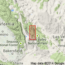
Type section: near Mexican Spring, southern Inyo Mountains, about 7.2 km northwest of Cerro Gordo Mine, between 8,920 and 8,970 ft elevation, in T. 15 S., R. 38 E., Lat. 36 deg. 35 min. 48 sec. N., Long. 117 deg. [49] min. 34 sec. W., southeastern part of the New York Butte 15-min quadrangle, [Cerro Gordo Peak 7.5-min quadrangle], Inyo Co., eastern CA. Named from Mexican Spring.
Reference section (= type section of Leaning Rock Formation): near Rest Spring in Cottonwood Mountains, about 4 km east of mouth of Perdido Canyon, between 6,160 and 6,240 ft elevation, in northwest corner of sec. 31, T. 13 S., R. 42 E., Lat. 36 deg. 45 min. 30 sec. N., Long. 117 deg. 26 min. 27 sec. W., White Top Mountain 7.5-min quadrangle, Inyo Co., Death Valley National Monument, eastern CA.
Source: Publication.
For more information, please contact Nancy Stamm, Geologic Names Committee Secretary.
Asterisk (*) indicates published by U.S. Geological Survey authors.
"No current usage" (†) implies that a name has been abandoned or has fallen into disuse. Former usage and, if known, replacement name given in parentheses ( ).
Slash (/) indicates name conflicts with nomenclatural guidelines (CSN, 1933; ACSN, 1961, 1970; NACSN, 1983, 2005, 2021). May be explained within brackets ([ ]).