The National Geologic Map Database is migrating to a new infrastructure. We apologize for any service disruptions during this process.
|
|---|


- Usage in publication:
-
- Mesquite schist
- Modifications:
-
- Original reference
- Dominant lithology:
-
- Schist
- AAPG geologic province:
-
- San Joaquin basin
Summary:
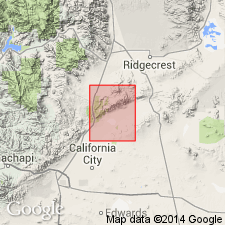
Pg. 12 (fig. 1), 14-15, pls. 1-3. Mesquite schist. Chlorite-quartz-albite-sericite schist; dark steel gray when fresh, weathers to light silvery gray; prominently and thinly bedded; uppermost 500 feet contains many interbeds of fine crystalline limestone, some as much as 10 feet thick. Total thickness about 4,500 feet. Schist dips east under Garlock series (new); contact sharp, concordant; probably a disconformity. Columnar section shows Mesquite schist younger than Rand schist. Age is Precambrian(?).
Exposed in Mesquite Canyon in El Paso Mountains, Saltdale quadrangle, Kern Co., southern CA.
Source: US geologic names lexicon (USGS Bull. 1200, p. 2480-2481).

- Usage in publication:
-
- Mesquite Schist*
- Modifications:
-
- Geochronologic dating
- AAPG geologic province:
-
- San Joaquin basin
Summary:
Pg. 9, 10, geologic time scale (inside front cover). Mesquite Schist of Dibblee (1952). Phyllite sample from a sericite, quartz-plagioclase(?), epidote(?) rock, on west side of Mesquite Canyon along road at boundary between sec. 17 and 18, T. 29 S., R. 39 E., Lat. 35 deg. 24 min. 58 sec. N., Long. 117 deg. 49 min. 31 sec. W., Garlock quadrangle, Kern County, California, yielded a K-Ar age of 189 +/-5 Ma (whole-rock). Age calculated using decay constants of Steiger and Jager, 1977 (Earth Planet. Sci. Letters, v. 36, p. 359-362). Age is minimum time of metamorphism [close to Triassic-Jurassic boundary (195 to 190 Ma)]; may have been lowered by thermal effects from nearby large granitoid plutons.
Source: Publication.
For more information, please contact Nancy Stamm, Geologic Names Committee Secretary.
Asterisk (*) indicates published by U.S. Geological Survey authors.
"No current usage" (†) implies that a name has been abandoned or has fallen into disuse. Former usage and, if known, replacement name given in parentheses ( ).
Slash (/) indicates name conflicts with nomenclatural guidelines (CSN, 1933; ACSN, 1961, 1970; NACSN, 1983, 2005, 2021). May be explained within brackets ([ ]).