

- Usage in publication:
-
- Meshik formation*
- Modifications:
-
- Named
- Dominant lithology:
-
- Ash
- Clay
- Andesite
- AAPG geologic province:
-
- Alaska Peninsula province
- Alaska Southwestern region
Summary:
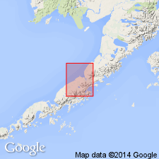
Typically developed along sides of valley of Meshik River and Meshik Lake, Aniakchak district, Alaska Peninsula, AK. Described on map legend as purple and green-gray andesitic agglomerate, varicolored volcanic ash and bentonitic clay, and black soil, all poorly stratified and of fluviatile and eolian origin. Contains some andesite flows. Thickness ranges from 2000 to 4000 ft. Overlies Eocene beds where base is exposed. Unconformably underlies Pleistocene deposits. In absence of fossil evidence age is probably Oligocene or early Miocene.
Source: GNU records (USGS DDS-6; Menlo GNULEX).
- Usage in publication:
-
- Meshik Formation*
- Modifications:
-
- Age modified
- Biostratigraphic dating
- Geochronologic dating
- AAPG geologic province:
-
- Alaska Peninsula province
- Alaska Southwestern region
Summary:
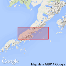
Well exposed in mountains south of Meshik River, along Rudy and Wolf Creeks. Is at least 1500 m thick. Unconformably overlies Tolstoi Formation; unconformably underlies Bear Lake Formation. Flows enclose petrified wood and contain abundant leaves of late Eocene age (J.A. Wolfe, oral commun., 1978). K-Ar ages of 35 to 30 Ma were obtained on basalt (F.H. Wilson, unpub. data, 1979). Map legend shows age as Eocene and Oligocene.
Source: GNU records (USGS DDS-6; Menlo GNULEX).
- Usage in publication:
-
- Meshik Volcanics*
- Modifications:
-
- Redescribed
- Age modified
- AAPG geologic province:
-
- Alaska Peninsula province
- Alaska Southwestern region
Summary:
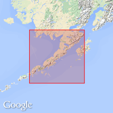
Unit redescribed as Meshik Volcanics owing to diverse lithology. Age given as late Eocene and early Oligocene.
Source: GNU records (USGS DDS-6; Menlo GNULEX).
For more information, please contact Nancy Stamm, Geologic Names Committee Secretary.
Asterisk (*) indicates published by U.S. Geological Survey authors.
"No current usage" (†) implies that a name has been abandoned or has fallen into disuse. Former usage and, if known, replacement name given in parentheses ( ).
Slash (/) indicates name conflicts with nomenclatural guidelines (CSN, 1933; ACSN, 1961, 1970; NACSN, 1983, 2005, 2021). May be explained within brackets ([ ]).