

- Usage in publication:
-
- Merritt Dam Member
- Modifications:
-
- Original reference
- Dominant lithology:
-
- Sandstone
- AAPG geologic province:
-
- Chadron arch
- Salina basin
Summary:
Pg. 230 (fig. 3), 246 (fig. 4), 294 (fig. 13), 297, 303-316, 338-345 (figs. 32-38). Merritt Dam Member of Ash Hollow Formation of Ogallala Group. Recognized in central northern Nebraska. Consists of thin-bedded sandstone containing calcareous or marly zones and layers of vitric tuff and ash beds. Thickness at type section 65 feet; up to 190 feet near the reservoir. Overlies Cap Rock Member of Ash Hollow; underlies Quaternary Sand Hills terrain. Includes [informal] Davis and Machaerodus ash beds (see p. 297, 307, this report). Glass shards from Davis ash yielded a fission-track age of 10.2 +/-0.7 Ma (Boellstorff, personal commun.); zircons yielded an age of 9.7 +/-1.2 Ma (Izett, 1975, GSA Mem. 144, p. 202). Glass shards from Machaerodus ash yielded a fission-track age of 9.5 +/-0.8 Ma (Boellstorff, personal commun.). Contains vertebrate fossil beds (late Clarendonian NALMA; at least one site contains a possibly late? Hemphillian fauna). Age is considered late Miocene.
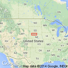
Type section: outcrop above Burge quarry on east side of Snake River Canyon, in NW/4 NE/4 NE/4 SE/4 sec. 15, T. 32 N., R. 30 W., [approx. Lat. 42 deg. 45 min. N., Long. 100 deg. 48 min. 52 sec. W., bdry. of Snake River Falls and Kilgore SE 7.5-min quadrangles], Cherry Co., central northern NE. Named from Merritt Reservoir Dam, 9 mi south-southwest of type section. (= section published by Johnson, 1936, Amer. Jour. Sci., v. 31, fig. 2.)
Reference section (upper part of member): on north side of Merritt Reservoir, in NW/4 sec. 29, T. 31 N., R. 30 W., [southwest corner Snake River Falls 7.5-min quadrangle], Cherry Co., central northern NE.
Source: Publication; US geologic names lexicon (USGS Bull. 1565, p. 198).
For more information, please contact Nancy Stamm, Geologic Names Committee Secretary.
Asterisk (*) indicates published by U.S. Geological Survey authors.
"No current usage" (†) implies that a name has been abandoned or has fallen into disuse. Former usage and, if known, replacement name given in parentheses ( ).
Slash (/) indicates name conflicts with nomenclatural guidelines (CSN, 1933; ACSN, 1961, 1970; NACSN, 1983, 2005, 2021). May be explained within brackets ([ ]).