The National Geologic Map Database is migrating to a new infrastructure. We apologize for any service disruptions during this process.
|
|---|


- Usage in publication:
-
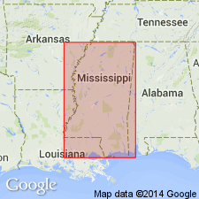
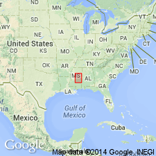
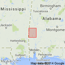
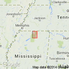
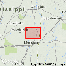
- Meridian sand member
- Modifications:
-
- Original reference
- Dominant lithology:
-
- Sand
- AAPG geologic province:
-
- Mid-Gulf Coast basin
Summary:
[On p. 1 Lowe states that Claiborne group of Mississippi includes Meridian sand member and Tallahatta, Winona, Lisbon, and Yegua (or "Cockfield") formations. On p. 105-106 he gives sections around Meridian, Lauderdale County, southeastern Mississippi, where he shows basal member of Tallahatta formation to consist of 75 feet of sand, but he does not on those pages use Meridian sand member. Age is middle Eocene.]
Source: US geologic names lexicon (USGS Bull. 896, p. 1351).
- Usage in publication:
-
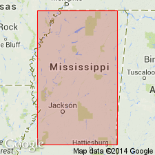
- Meridian sand member
- Modifications:
-
- Areal extent
- AAPG geologic province:
-
- Mid-Gulf Coast basin
Summary:
Pg. 20. Meridian sand member of Tallahatta formation. Basal member of Tallahatta formation; underlies Basic member. [Age is middle Eocene.]
Source: US geologic names lexicon (USGS Bull. 1200, p. 2469).
- Usage in publication:
-
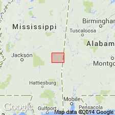
- Meridian sand member
- Modifications:
-
- Areal extent
- AAPG geologic province:
-
- Black Warrior basin
Summary:
Pg. 46-47. Meridian sand member of Tallahatta formation. Thickness of member 61 feet in Winston County, Mississippi. Underlies Basic member; overlies Hatchetigbee formation. [Age is middle Eocene.]
Source: US geologic names lexicon (USGS Bull. 1200, p. 2469).
- Usage in publication:
-
- Meridian formation
- Modifications:
-
- Revised
- AAPG geologic province:
-
- Mid-Gulf Coast basin
Summary:
Pg. 63-64, 68-72. Meridian formation. Rank raised to formation. Lowe recognized probability of unconformity at top of [Meridian] sand and, in uncompleted manuscript, separated basal Claiborne sands as a distinct formation. Since it is now established that stratigraphic relations are disconformable both above and below and that sands constitute a stratigraphic unit which is different lithologically from overlying and underlying beds, the Meridian is now generally considered to be of formational rank. Thickness 70 to 100 feet in Lauderdale County, southeastern Mississippi. Overlies Hatchetigbee formation; underlies Tallahatta formation. [Age is middle Eocene.]
Source: US geologic names lexicon (USGS Bull. 1200, p. 2469).
- Usage in publication:
-
- Meridian formation
- Modifications:
-
- Age modified
- AAPG geologic province:
-
- Mid-Gulf Coast basin
Thomas, E.P., 1942, The Claiborne: Mississippi Geological Survey Bulletin, no. 48, 96 p.
Summary:
Pg. 16. Meridian formation. Meridian is uppermost Wilcox. Reasons presented for this age designation.
Source: US geologic names lexicon (USGS Bull. 1200, p. 2469).
- Usage in publication:
-
- Meridian sand member
- Modifications:
-
- Areal extent
- AAPG geologic province:
-
- Mid-Gulf Coast basin
Summary:
Pl. 3. Meridian sand member of Tallahatta formation. Correlation chart shows Meridian sand member present in Choctaw County, western Alabama. [Age is middle Eocene.]
Source: US geologic names lexicon (USGS Bull. 1200, p. 2469).
- Usage in publication:
-
- Meridian formation
- Modifications:
-
- Areal extent
- AAPG geologic province:
-
- Mid-Gulf Coast basin
Summary:
Pg. 43-54. Meridian formation described in Benton County, southeastern Mississippi, about 100 to 150 feet thick. Commonly a very coarse to medium sand. On outcrop, usually reddish brown, but, where fresh and a few feet above its lower contact, characteristically banded light and dark brown. Disconformity at base of formation well exhibited; upper contact not so clear. As result of lateral change of Tallahatta formation from shale to sand, exact Meridian-Tallahatta contact can be determined at only a few locations. Overlap of Meridian formation has added to confusion of age determination of Meridian as well as overlying Wilcox strata. Claiborne group. [Age is middle Eocene.]
Source: US geologic names lexicon (USGS Bull. 1200, p. 2469).
- Usage in publication:
-
- Meridian sand member
- Modifications:
-
- Areal extent
- AAPG geologic province:
-
- Mid-Gulf Coast basin
Summary:
Pg. 189, pls. 1, 5. Meridian sand member of Tallahatta formation. Probably present at surface in southeastern corner of Kemper County, southeastern Mississippi. Sand might be included in either Wilcox or Claiborne group. Mississippi Geological Survey includes Meridian sand member in the Claiborne. [Age is middle Eocene.]
Source: US geologic names lexicon (USGS Bull. 1200, p. 2469).
- Usage in publication:
-
- Meridian Sand Member
- Modifications:
-
- Age modified
- AAPG geologic province:
-
- Mid-Gulf Coast basin
Summary:
In eastern AL and western GA Gulf Coastal Plain, Bashi Marl Member (lower) of Hatchetigbee Formation and its so called "unnamed upper member" are time equivalent, and all facies of Hatchetigbee were deposited during earliest early Eocene (lower half of calcareous nannofossil Zone NP10, radiometric age of 53.0-53.5 Ma). Hatchetigbee generally accepted as top of Wilcox Group, and overlying Tallahatta Formation with its Meridian Sand Member (not extended to GA) generally accepted as base of Claiborne Group. Lower Tallahatta-Meridian beds indicate placement in late early Eocene (calcareous nannofossil Zone NP13, radiometric age of 49.3-50.4 m.y.), suggesting hiatus between Wilcox-Claiborne unconformity of minimum time of 2.6 m.y. Therefore Wilcox-Claiborne boundary is in early Eocene, and Claiborne-Tallahatta-Meridian age changed from early middle Eocene to: late early and early middle Eocene.
Source: GNU records (USGS DDS-6; Reston GNULEX).
- Usage in publication:
-
- Meridian Sand
- Modifications:
-
- Areal extent
- AAPG geologic province:
-
- Mid-Gulf Coast basin
Summary:
Meridian Sand at the base of the Claiborne Group described in Newton Co., MS, as nonfossiliferous cross-bedded, characteristically light brown, medium- to coarse-grained, moderately- to well-sorted, subangular quartz sand with minor amounts of mica. Clayballs, 4 in. in diameter, are present in the lower portions of the Meridian, a result of reworking of Hatchetigbee underclays. Unit varies considerably in thickness. Minimum thickness (in Test Hole A0-8) is 9 ft and maximum thickness (in water wells K1 and K2) is 40 ft. Disconformably underlies the Basic City Shale Member of the Tallahatta Formation and disconformably overlies the Hatchetigbee Formation of the Wilcox Group. Both contacts are erosional surfaces. The Meridian represents an upslope fluvial facies, probably braided stream or meanderbelt. Age is Eocene.
Source: GNU records (USGS DDS-6; Reston GNULEX).
- Usage in publication:
-
- Meridian Sand
- Modifications:
-
- Overview
- AAPG geologic province:
-
- Mid-Gulf Coast basin
Summary:
Used in this report as Meridian Sand of Claiborne Group. Workers disagree concerning stratigraphic placement. Mississippi Bureau of Geology and USGS place unit in Claiborne, while other workers place it in Wilcox. Fluvial environment proposed by Duplantis (1975) best fits sequence exposed at Mt. Barton. Underlies Basic City Shale Member of Tallahatta Formation. Unconformably overlies Hatchetigbee Formation. Age is early middle Eocene.
Source: GNU records (USGS DDS-6; Reston GNULEX).

- Usage in publication:
-
- Meridian Sand Member
- Modifications:
-
- Overview
- AAPG geologic province:
-
- Mid-Gulf Coast basin
Summary:
In southwest AL, the lower 8 to 10 ft of the Tallahatta Formation is the Meridian Sand Member, a white to light-greenish-gray fine to coarse sand and fine gravel. Unconformably overlies the Hatchetigbee Formation. Age is Claibornian (late Ypresian).
Source: GNU records (USGS DDS-6; Reston GNULEX).
- Usage in publication:
-
- Meridian
- Modifications:
-
- Overview
- AAPG geologic province:
-
- Mid-Gulf Coast basin
GNU Staff, 1994, GNU Staff remark.: U.S. Geological Survey Digital Data Series, DDS-6, 1 CD-ROM., release 3
Summary:
Name Meridian was first used by W.J. McGee in 1891 (USGS 12th Annual Report, pt. 1) to describe a distinctive rock mass typically displayed in vicinity of Meridian. It was labeled Meridian formation or Meridian buhrstone, and described as composed of hard siliceous ledges, with intercalated beds of indurated siliceous clay or marl and displaying moderately regular bedding. Though compositionally uniform, described as texturally diverse because of variable degrees of lithification, and containing brittle nodules, plates, and lenses. Formation was later described by James Turner (1952) in Yalobusha Co., MS, as 40 to 125 ft thick, overlying Ackerman formation and underlying Tallahatta formation. Position in basal Claiborne appears to be the same as the Meridian sand member of Lowe (1933), but contact with the Tallahatta is described quite differently, as is the lithology. Lowe recognized the contact as an unconformity (noted in an unpublished manuscript by Foster), while Turner speaks of interlensing between the two. An Eocene age is assigned to both and they have been treated as separate units, in both the Wilmarth and Keroher lexicons. A note in Bulletin 896 indicates that the Meridian buhrstone was replaced by the Tallahatta formation, but there is no mention of this in the later lexicon, and in fact, it is stated that the unit underlies the Tallahatta. GNU records indicate that this first usage has been abandoned. A handwritten note by M. Grace Wilmarth, dated September 13, 1918, states, "In bringing my stratigraphic catalog up to date, I discovered "Meridian formation or Meridian buhrstone" of McGee (USGS, 12th Ann. Rept., Pt. 1, 1891, pp. 414-415). The name is not in Weeks-Nickles catalog. It is the first name introduced to replace "Buhrstone," and has 6 years priority over Tallahatta (1897). Tallahatta did not come into general use until 1907, but since that time it has become so firmly established in literature (and Meridian has not been used at all) that T.W.S. [T.W. Stanton, GNC Chairman] said only thing to do now is to abandon 'Meridian.'"
Source: GNU records (USGS DDS-6; Reston GNULEX).
- Usage in publication:
-
- Meridian Sand
- Modifications:
-
- Overview
- AAPG geologic province:
-
- Mid-Gulf Coast basin
Summary:
Meridian Sand of Claiborne Group. Unconformably overlies Hatchetigbee Formation of Wilcox Group; overlies Wilcox Group [undivided] in downdip (south) area. Conformably underlies Tallahatta Formation of Claiborne; underlies and intertongues with Cane River Formation of Claiborne in downdip (south) area. Age is early Eocene (Ypresian); nannofossil zones NP12 to NP13, planktic foram zones P7 to P9.
Source: Publication.
For more information, please contact Nancy Stamm, Geologic Names Committee Secretary.
Asterisk (*) indicates published by U.S. Geological Survey authors.
"No current usage" (†) implies that a name has been abandoned or has fallen into disuse. Former usage and, if known, replacement name given in parentheses ( ).
Slash (/) indicates name conflicts with nomenclatural guidelines (CSN, 1933; ACSN, 1961, 1970; NACSN, 1983, 2005, 2021). May be explained within brackets ([ ]).