- Usage in publication:
-
- Merced Falls slate*
- Modifications:
-
- Original reference
- Dominant lithology:
-
- Slate
- Siltstone
- Graywacke
- Tuff
- AAPG geologic province:
-
- San Joaquin basin
Summary:
Pg. 30, pls. 1-11. Merced Falls slate. Near Tuolumne River is almost entirely thin-bedded dark-gray slate and siltstone; one thin bed of graywacke. Along Merced River includes considerable graywacke and some felsic tuff. Top of formation not preserved but about 5,000 feet of strata form type section. Overlies and intertongues with Gopher Ridge volcanics (new). Apparently underlies and intertongues with Peaslee Creek volcanics (new). Rocks of Merced Falls were shown as epiclastic rocks by Turner, 1897 (USGS Geol. Atlas of the US, Sonora folio, no. 41) in belt extending southeastward from La Grange to beyond southern boundary of area mapped in present report. Age is Late Jurassic.
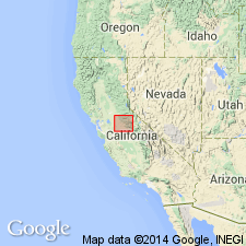
Type section: along Merced River east of town of Merced Falls, Merced Co., east-central CA.
[Author does not capitalize rank terms; however, units are considered formal.]
Source: US geologic names lexicon (USGS Bull. 1350, p. 482).
For more information, please contact Nancy Stamm, Geologic Names Committee Secretary.
Asterisk (*) indicates published by U.S. Geological Survey authors.
"No current usage" (†) implies that a name has been abandoned or has fallen into disuse. Former usage and, if known, replacement name given in parentheses ( ).
Slash (/) indicates name conflicts with nomenclatural guidelines (CSN, 1933; ACSN, 1961, 1970; NACSN, 1983, 2005, 2021). May be explained within brackets ([ ]).

