The National Geologic Map Database is migrating to a new infrastructure. We apologize for any service disruptions during this process.
|
|---|


- Usage in publication:
-
- Mendon series
- Modifications:
-
- Named
- Dominant lithology:
-
- Schist
- Quartzite
- Conglomerate
- Limestone
- AAPG geologic province:
-
- New England province
Summary:
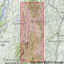
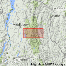
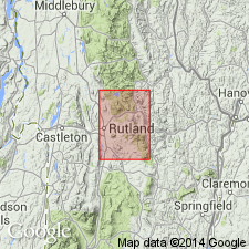
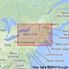
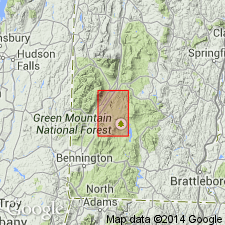
Named for good exposures in town of Mendon, 1 mi south of Mendon Village, Rutland Co., southwestern VT. Consists of more or less metamorphosed clastic rocks of sedimentary origin [conglomerate, arkose, quartzite, calcite, marble, dolomite, calcareous schist, biotite schist, chlorite schist, actinolite schist, tourmalinized schist, and gneiss]. Thickness ranges from 200 to 2,000 ft. Overlies Mount Holly gneiss; unconformably(?) underlies Lower Cambrian quartzite. Age is Precambrian (Algonkian).
Source: GNU records (USGS DDS-6; Reston GNULEX).
- Usage in publication:
-
- Mendon schist*
- Modifications:
-
- Revised
- AAPG geologic province:
-
- New England province
Summary:
Pg. 265. Mendon schist. Over Mount Holly gneiss lies a succession of mica schist and quartzite, including some limestone or dolomite with a prominent structure that strikes nearly due north. This assemblage was called "Mendon series" by Whittle. Being chiefly schists, it is here called Mendon schist. It is of younger pre-Cambrian age, and unconformably underlies quartzite containing Lower Cambrian fossils.
Source: US geologic names lexicon (USGS Bull. 896, p. 1345).
- Usage in publication:
-
- Mendon formation
- Modifications:
-
- Revised
- Age modified
- AAPG geologic province:
-
- New England province
Summary:
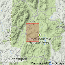
Mendon series revised as Mendon formation to conform with present stratigraphic usage. Crops out along upper part of western escarpment of Green Mountains and underlies summit and eastern slopes of Mount Moosalamoo. Also underlies area between Chandler Ridge and Romance Mountain. Pebbly crystalline limestone member mapped by Whittle (1894) is here referred to as Forestdale member [rank reduced from Forestdale marble of Keith (1932)]. Mica schist member mapped by Whittle (1894) is here referred to as Moosalamoo member [rank reduced from Moosalamoo phyllite of Keith (1932)]. Forestdale is 600 ft above base of Mendon; Moosalamoo is lenticular body in upper part of Mendon. Thickness of Mendon is 800 to 1,800 ft. Underlies Cheshire quartzite. Age changed to Early Cambrian based on work of Prindle and Knopf (1932) who cite OLENELLUS in quartzite above rocks known to be Precambrian. Micaceous phyllite overlies quartzite and is in turn overlain by more quartzite. This relationship is seen in Moosalamoo member and Cheshire quartzite in Rochester-East Middlebury, VT, area. If this interpretation is correct, beds of quartzite containing OLENELLUS underlie equivalent of Moosalamoo and therefore must represent quartzites interbedded with equivalent of lower part of Mendon formation. This implies that rocks below Cheshire quartzite and above Precambrian rocks are Early Precambrian.
Source: GNU records (USGS DDS-6; Reston GNULEX).
- Usage in publication:
-
- Mendon formation
- Modifications:
-
- Revised
- AAPG geologic province:
-
- New England province
Summary:
Lowermost member of Mendon formation is here referred to as Nickwacket member [rank reduced from Nickwacket graywacke of Keith (1932)]. Consists of graywacke, quartzite, and conglomerate. Thickness ranges from 25 to 800 ft. Overlies Mount Holly complex; underlies Forestdale member of Mendon.
Source: GNU records (USGS DDS-6; Reston GNULEX).
- Usage in publication:
-
- Mendon Formation*
- Modifications:
-
- Age modified
- AAPG geologic province:
-
- New England province
Summary:
Age of Mendon given as Cambrian(?). [No reasons given. No mention of previous ages of other workers.]
Source: GNU records (USGS DDS-6; Reston GNULEX).
- Usage in publication:
-
- Mendon Formation*
- Modifications:
-
- Age modified
- AAPG geologic province:
-
- New England province
Summary:
Age changed to Early Cambrian(?) because Mendon is overlain by formations of Early Cambrian age.
Source: GNU records (USGS DDS-6; Reston GNULEX).
- Usage in publication:
-
- Mendon Formation
- Modifications:
-
- Not used
- AAPG geologic province:
-
- New England province
Summary:
Rocks previously mapped as Mendon Formation in this area are here called Dalton Formation following the usage on the Vermont State geologic map by Doll and others (1961).
Source: GNU records (USGS DDS-6; Reston GNULEX).
For more information, please contact Nancy Stamm, Geologic Names Committee Secretary.
Asterisk (*) indicates published by U.S. Geological Survey authors.
"No current usage" (†) implies that a name has been abandoned or has fallen into disuse. Former usage and, if known, replacement name given in parentheses ( ).
Slash (/) indicates name conflicts with nomenclatural guidelines (CSN, 1933; ACSN, 1961, 1970; NACSN, 1983, 2005, 2021). May be explained within brackets ([ ]).