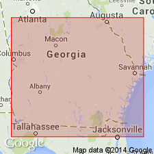
- Usage in publication:
-
- Meigs Member
- Modifications:
-
- Named
- Dominant lithology:
-
- Sand
- Clay
- AAPG geologic province:
-
- South GA-North FL sedimentary province
Summary:
Meigs Member of the Coosawhatchie Formation (Hawthorne Group) is here named for exposures near the village of Meigs, Thomas Co., south-central GA. Unit is described as an argillaceous, well-sorted, fine-grained sand and thinly bedded to laminated, variably siliceous and diatomaceous clay. Locally mined for fuller's earth. Meigs is recognized only along the trend of the Gulf Trough from northwestern Thomas Co., through northern Coffee Co., to northern Toombs and southern Emanuel Cos. Strata have been included by previous workers with the Alum Bluff Formation, the Tampa Limestone, or the Chipola Formation (all restricted from GA in this report). Presumed to grade laterally eastward into the lower part of the Coosawhatchie. In the type area, disconformably underlies the upper Pliocene Miccosukee Formation; elsewhere conformably and gradationally underlies the Altamaha Formation; overlies Marks Head Formation equivalent. Thickness of 47.5 ft (15 m) to 82 ft (25 m) is indicated in the type area. Maximum thickness is probably 96 ft (29 m). Age is middle Miocene based on diatoms.
Source: GNU records (USGS DDS-6; Reston GNULEX).
For more information, please contact Nancy Stamm, Geologic Names Committee Secretary.
Asterisk (*) indicates published by U.S. Geological Survey authors.
"No current usage" (†) implies that a name has been abandoned or has fallen into disuse. Former usage and, if known, replacement name given in parentheses ( ).
Slash (/) indicates name conflicts with nomenclatural guidelines (CSN, 1933; ACSN, 1961, 1970; NACSN, 1983, 2005, 2021). May be explained within brackets ([ ]).

